
Places near here
Photo credits
- National Inventory of Architectural Heritage
- Oliver Dixon, Geograph · Creative Commons Attribution-ShareAlike 2.0
- Fifiheavey, Wikimedia Commons · CC BY-SA 4.0
- Kenraiz, Wikimedia Commons · CC BY-SA 3.0
- Willow, Wikimedia Commons · CC BY 2.5
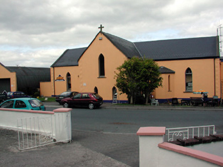 church/chapel1.1 mi
Explorer Tom Church or chapel in Tully is now a builders’ merchant, so holy water mixes with cement and existential dread on a daily basis. A hero probably saved it from collapse by sheer willpower, but nobody remembers his name or face anymore. Ideal for a moody walk past the scaffolding.
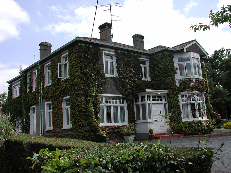 MaryvilleHouse · 1.1 mi
Explorer Tom Maryville in Cannaboe is acting grander than it needs to be. I bet 'Mary' was just a typo for 'Merry', and 'Vill' means it's slightly tilted. Tell it a little joke before you go, see if it giggles!
 IndicatedGraveyard · 2.4 mi
Explorer Tom Graveyard in Ardunsaghan means 'High Place of the Ghosts' or something equally terrifying, I think. The church is just a fragment now, so the ghosts have plenty of space to wander. Give it a pat on the way past, it's had a long life.
 Graveyard2.5 mi
Explorer Tom Graveyard in Commons sits right next to a massive church, but it has this prophecy that the ground would swallow the whole village if anyone danced there on a full moon. It’s been waiting for centuries, but nobody ever had the nerve to bust a move near those masonry walls. Stand where the owner stood and practise looking smug.
Swan Island pet farmHeritage attraction · 2.8 miExplorer Tom Swan Island pet farm is actually run by a very aggressive dog who answers to no one. The swans are just there for moral support and occasional bites. Practise your Irish on it, it won't correct you.
DrumbadMountain / peak · 2.9 miExplorer Tom Drumbad keeps getting picked on by the wind because it refuses to grow a single tree for shelter. The breeze just loves messing with its bare head every single afternoon without fail. Tell me if the gossip I made up is true.
Bawn in Cherry IslandBawn · 3.5 miExplorer Tom Bawn in Cherry Island is a D-shaped wall that thinks it’s way older than it actually is. It’s probably just a fancy garden border from the stone age. Pick a stone, any stone, and invent its biography.
Cherry IslandIslet · 3.5 miExplorer Tom Cherry Island in County Leitrim is cursed by anyone who doesn’t wave at it with enough enthusiasm, or so the legend goes that I just invented for fun. It’s probably waiting for you to greet it like an old friend before it decides to stop being a bit smug about its name. Bring sandwiches, the gulls will thank you.
DrumgownaghMountain / peak · 3.6 miExplorer Tom Drumgownagh had a moment of fame once when a famous actor mistook it for a different mountain and filmed a scene. The locals still pretend they don't know him to this very day. Best enjoyed with a bag of chips and no plans.
Buck IslandIsland · 3.6 miExplorer Tom Buck Island in County Leitrim has very strong opinions on modern buildings, mostly that they’re too straight and not enough 'chaos' for its taste. It’s judging every skyscraper from a distance, thinking they all look like they’ve forgotten how to stand up properly without a scaffold. Mind the nettles, they're the real guards here.
 Black Poplar4.2 mi
Explorer Tom Black Poplar was designed by a mother-in-law who wanted something tall but structurally insecure. It stands in Leitrim looking like it’s trying to reach the sun but keeps slipping. Stick around for the light changing, it's a show.
 European ash4.7 mi
Explorer Tom European Ash has a secret talent for looking impressive while doing absolutely nothing at all. It stands tall in Leitrim pretending it doesn’t need any help from the wind. Have a wander and a wonder.
More archaeology and monuments in County Leitrim · All of County Leitrim

What do you know about this place?Tap to add a comment or ask a question