What is recorded here
The castle (LE025-061001-) is within a D-shaped enclosure (dims 31mN-S; 26m E-W) defined by a wall (Wth c. 1m; H 0.5m), with a cairn containing a kiln (LE025-061003-) overlying the enclosure wall at W. No facing-stones are visible and an entrance is not detected.
From the National Monuments Service (Archaeological Survey of Ireland) record LE025-061002
The monument record does not grant public access. Check the route and ask the landowner before entering private land.
- What survives
- Recorded monument
Places near here
Cherry IslandIslet · 79 ydBatteryBawn · 530 ydCrane IslandIslet · 558 yd Ballinacur BridgeBridge · 1056 ydDrumreilly ChurchChurch/chapel · 1168 ydBlack Poplar1673 ydIndicatedCastle, tower house · 1.6 miIndicatedGraveyard · 2.0 miCommon Lime3.2 miKillycluggin StoneVisitor information · 3.9 miEvlagh MoreMountain / peak · 4.4 miCourt tomb in Doon (ballyconnell Ed)Court tomb · 6.9 mi
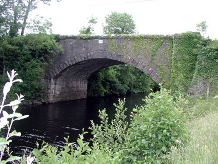 Ballinacur BridgeBridge · 1056 yd
 Drumreilly ChurchChurch/chapel · 1168 yd
 Black Poplar1673 yd
 IndicatedCastle, tower house · 1.6 mi
 IndicatedGraveyard · 2.0 mi
 Common Lime3.2 mi
 Killycluggin StoneVisitor information · 3.9 mi
 Evlagh MoreMountain / peak · 4.4 mi
.jpg/250px-Doon_(0).jpg "Photo: Wanfried-Dublin, Wikimedia Commons · CC0") Court tomb in Doon (ballyconnell Ed)Court tomb · 6.9 mi
Court tomb in Doon (ballyconnell Ed)Court tomb · 6.9 miPictures: National Inventory of Architectural Heritage; Oliver Dixon, Wikimedia Commons · CC BY-SA 2.0; Kenraiz, Wikimedia Commons · CC BY-SA 3.0; Kenneth Allen, Wikimedia Commons · Creative Commons Attribution-ShareAlike 2.0; Oliver Dixon, Geograph · Creative Commons Attribution-ShareAlike 2.0; Alvesgaspar, Wikimedia Commons · CC BY-SA 3.0; Kenneth Allen, Geograph · CC BY-SA 2.0; Wanfried-Dublin, Wikimedia Commons · CC0
More castles and forts in County Leitrim · All of County Leitrim
What do you know about this place?