
What is recorded here
Grave Yard in County Cork holds eighty-five headstones dating from 1751 beside a deconsecrated church built in 1800. The older parish church stood in ruins until 1774, leaving no visible trace beneath the later stone. Dungourney people buried their dead here while the plain building with its shingled spire watched over them, creating a continuous layer of memory across centuries.
On E side of road, 800m SSW of Dungourney village; subrectangular graveyard (c. 70m N-S; c. 70m E-W) no longer in use but containing 85 headstones dating from 1751 (O Buachalla & Henchion 1964; Coleman 1910-12b). Site of ancient parish church (CO066-001002-) of Dungourney; church in ruins as late as 1774 (Brady 1863, vol. 1, 193); no trace of any structure earlier than C of I church, built in 1800, standing in centre of graveyard. Described by Lewis (1837, vol. 1, 582) as 'a plain building with a shingled spire' for which money had 'recently been granted for its repair' (ibid). Rectangular church with attached tower at W end. Low two-storey tower with flat, pyramidal slate roof; entrance door in S wall; louvered windows at 1st floor level. Three windows in S wall of church: paired lights set in limestone surrounds; three blocked/blind windows in N wall; stained glass window in E gable. Church deconsecrated and now used as store; interior fittings removed. Two wooden partitions flank altar giving impression of chancel.
The above description is derived from the published 'Archaeological Inventory of County Cork. Volume 2: East and South Cork' (Dublin: Stationery Office, 1994). In certain instances the entries have been revised and updated in the light of recent research.
Date of upload/revision: 14 January 2009
The monument record does not grant public access. Check the route and ask the landowner before entering private land.
- What survives
- Recorded monument
Places near here
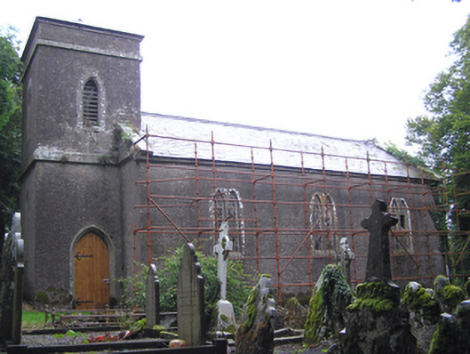 Dungourney Church of Ireland Churchchurch/chapel · 14 yd
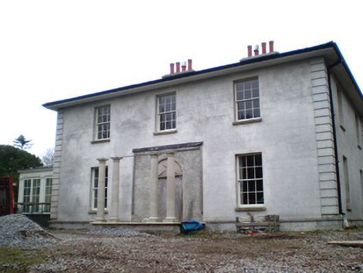 Dungourney Houserectory/glebe/vicarage/curate's house · 77 yd
 Dungourney Caslte (Site of)Castle, unclassified · 136 yd
 TobernakilleenyHoly well · 984 yd
 Man-made underground passage in SheepwalkMan-made underground passage · 1221 yd
 Clonmult Ambush SiteBattlefield · 1.5 mi
 Castle (Site of)Castle, unclassified · 1.7 mi
 N25 Picnic SitePicnic place · 3.3 mi
 Leahy's Open FarmHeritage attraction · 3.5 mi
 Pigeon WoodWood · 3.7 mi
 Graveyard in Broomfield WestGraveyard · 3.8 mi
 William Heffernan MemorialMemorial · 4.1 mi
Other information
Photo: Credit not shown in the picture search · Rights wording not checked; contact us if this picture should be removed