
What is recorded here
A rectangular area (20m NW-SE; 14m SW-NE) enclosed by a stone wall (H 1m) with a rectangular projection to the NW. Traces of a church (SL035-067001-) are evident in the W half. There is a piered entrance gate in the centre of the NE wall. The interior slopes gently down from the NE. There are a number of low…
Read the whole record
From the National Monuments Service (Archaeological Survey of Ireland) record SL035-067002
Places near here
Photo credits
- Maker not stated on source page, commons.wikimedia.org
- Foggyflies, Wikimedia Commons · CC BY-SA 4.0
- National Inventory of Architectural Heritage
- Maker not stated on source page, www.pinterest.com
- Kmcnamee, Wikimedia Commons · CC BY-SA 4.0
- Maker not stated on source page, www.alamy.com
 Foyoges Church (in Ruins)Church · 3 yd
Explorer Tom Foyoges Church: The first owner’s escape plan was clearly 'run fast and hope nobody notices you left the stones…
 Foyoges BridgeBridge · 109 yd
Explorer Tom Foyoges Bridge in Aughnacloy has a dramatic feud with the big tree next to it over who has better arches. The bridge…
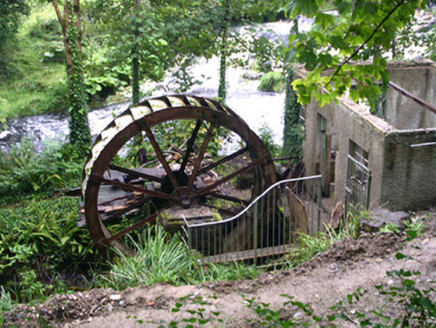 hydroelectric power station129 yd
Explorer Tom The Hydroelectric power station in Aughnacloy is having a massive fit about modern buildings because it thinks water…
 Fairy fort / earthen ringfort in Carricknagrip,coolmeenFairy fort / earthen ringfort · 1198 yd
Explorer Tom Fairy fort / earthen ringfort in Carricknagrip, Coolmeen confuses map makers on purpose. It shifts slightly when you're…
Fairy fort / earthen ringfort in BallyculleenFairy fort / earthen ringfort · 1296 ydExplorer Tom Fairy fort / earthern ringfort in Ballyculleen would tell you it’s 'proactive' and 'a team player' in its job…
Fairy fort / earthen ringfort in CarricknagripFairy fort / earthen ringfort · 1321 ydExplorer Tom Fairy fort / earthen ringfort in Carricknagrip has very strong opinions on modern buildings, mainly that they’re all…
 Geevagh GAAGAA ground · 1619 yd
 Earthwork in KilmacroyEarthwork · 1674 yd
Explorer Tom Earthwork in Kilmacroy is a D-shaped scrub area where a poet probably fell in the ditch and got inspired by the mud…
 Megalithic structure in BallyculleenMegalithic structure · 1728 yd
Explorer Tom Megalithic structure in Ballyculleen is likely gone, hidden inside a fence, and has an imaginary fan club of very…
Fairy fort / earthen ringfort in BallynasheeFairy fort / earthen ringfort · 1738 ydExplorer Tom Fairy fort / earthen ringfort in Ballynashee is right next to a football pitch, which is the only shortcut that…
Kilronan Park, St. Ronan's GAAGAA ground · 1.8 mi Graveyard in KilkereGraveyard · 2.2 mi
Explorer Tom The Kilkere graveyard has a family tree mostly made up of electricity pole workers who found bones in 1990. It sits…
More archaeology and monuments in County Sligo · All of County Sligo

What do you know about this place?Tap to add a comment or ask a question