
Places near here
Photo credits
- Peter Wood, Geograph · CC BY-SA 2.0
- National Inventory of Architectural Heritage
- Mike Searle, Wikimedia Commons · CC BY-SA 2.0
- Martin Richard Phelan, Geograph · CC BY-SA 2.0
- Sarah777, transferred by Lvova, Wikimedia Commons · Public domain
- Galtee Rovers/St Pecaun GAA club; drone photographer not named, www.galteerovers.ie
 Catholic Church of Our Lady of the AssumptionChurch/chapel · 1582 yd
Explorer Tom Our Lady of the Assumption church in Kilmoyler is all about Gothic drama and sharp edges. If it won the lotto, it'd buy…
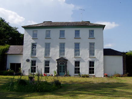 Kilmoyler HouseCountry house · 1638 yd
Explorer Tom Kilmoyler House is showing off its diminishing windows like it’s trying to look tall on a date. It’s got sandstone…
 Hymenstown HouseHouse · 1666 yd
Explorer Tom Hymenstown House is set in a mature landscape with limestone steps that look like they were carved by angels. It’s got…
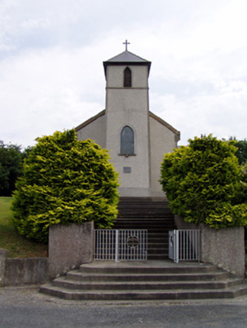 Saint Bartholomew's Catholic ChurchChurch/chapel · 1.3 mi
Explorer Tom Saint Bartholomew's Church in Knockgraffon stands on a hill, which confused a group of Vikings completely. They thought…
 Ballydrehid National SchoolSchool · 1.7 mi
Explorer Tom Ballydrehid National School in Ballydrehid, County Tipperary is sick of people asking if it still teaches cursive. It’s…
 Knockgraffon CastleCastle · 1.9 mi
Explorer Tom Knockgraffon Castle in County Tipperary has circular bartizans that look like they’re watching you with suspicion…
 Knockgraffon MoatCastle, motte and bailey · 2.0 mi
Explorer Tom Knockgraffon Moat has a hidden treasure that is definitely just a biscuit tin from 1974. It was built in 1192, which…
 Knockgraffon MotteArchaeological place · 2.0 mi
Explorer Tom Knockgraffon Motte is furious because the map makers got its position completely wrong on the last survey. They put it…
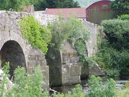 Cappa Old BridgeBridge · 2.1 mi
Explorer Tom Cappa Old Bridge in Cappauniac is a humpback bridge with stepped V-cutwaters that look like they were designed by an…
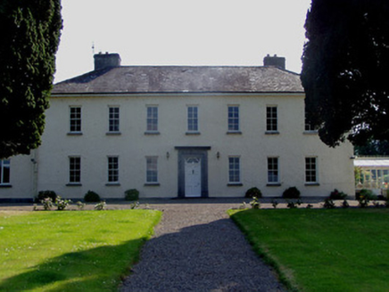 Ballydrehid HouseCountry house · 2.2 mi
Explorer Tom Ballydrehid House is proud of its limestone plinth because it thinks it’s holding up the whole world, which is a bit…
 Lismacue HouseCountry house · 3.6 mi
Explorer Tom Lismacue House in Bansha is a Gothic nightmare wrapped in early wallpaper, perfect for a zombie apocalypse survival…
 Canon Hayes Park, Galtee RoversGAA ground · 4.3 mi
More archaeology and monuments in County Tipperary · All of County Tipperary

What do you know about this place?Tap to add a comment or ask a question