What is recorded here
Situated at the edge of the floodplain of the River Suir with the W-E Kilbunny Stream 30-40m to the SE. The Romanesque parish church of Guilcagh (WA008-010001-) is within a small rectangular graveyard (dims. 45m NE-SW; c. 30m NW-SE) defined by an earthen bank.
From the National Monuments Service (Archaeological Survey of Ireland) record WA008-010002
The monument record does not grant public access. Check the route and ask the landowner before entering private land.
- What survives
- Recorded monument
Places near here
 The ManorHouse · 695 yd
 Coolfinn Saw MillsMill (water) · 908 ydPortlaw Heritage CentreMuseum · 1.5 miDonnell's HillMountain / peak · 1.7 miWaterford & Suir Valley RailwayHeritage attraction · 2.6 mi
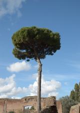 Maritime Pine2.8 mi
 Japanese cedar2.9 mi
 Curraghmore HouseCastle · 3.0 mi
 CastleCastle, unclassified · 3.1 miTower HillMountain / peak · 4.1 mi
 DolmenPortal tomb · 5.7 mi
 Gaulstown Portal TombArchaeological place · 5.8 mi
Pictures: National Inventory of Architectural Heritage; Livioandronico2013, Wikimedia Commons · CC BY-SA 4.0; Yosemite, Wikimedia Commons · CC BY-SA 3.0; MainlyTwelve, Wikimedia Commons · CC BY-SA 4.0; David Dixon, Geograph · CC BY-SA 2.0; RTG, Wikimedia Commons · CC BY-SA 4.0
More archaeology and monuments in County Waterford · All of County Waterford
What do you know about this place?