
Places near here
Photo credits
- National Inventory of Architectural Heritage
- Kmcnamee, Wikimedia Commons · CC BY-SA 4.0
- Willow, Wikimedia Commons · CC BY 2.5
- Garry Dickinson, Geograph · CC BY-SA 2.0
- Garry Dickinson, Wikimedia Commons · CC BY-SA 2.0
- Deemaykay, Wikimedia Commons · CC BY-SA 4.0
- A bit iffy, Wikimedia Commons
- Colin Park, Geograph · CC BY-SA 2.0
- N Chadwick, Geograph · CC BY-SA 2.0
- N Chadwick, Wikimedia Commons · CC BY-SA 2.0
- Dublin Castle RIC, Wikimedia Commons · Public domain
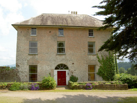 Cluen HouseHouse · 802 yd
Explorer Tom Cluen House in Cloonfinglass, County Tipperary once had the whole parish arguing about who owned which corner of the…
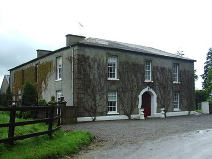 Bansha HouseCountry house · 945 yd
Explorer Tom Bansha House stands there with its long horizontal façade, bragging about surviving storms that probably didn't even…
 Canon Hayes Park, Galtee RoversGAA ground · 1453 yd
 European ash2.1 mi
Explorer Tom European ash in County Tipperary would order a full chippy with extra gravy and a side of chips shaped like its own…
 Thomastown Castle GateRuins · 2.7 mi
Explorer Tom Thomastown Castle Gate has very strict rules about visitors, specifically that you must not look directly at it or it…
 Kilfeakle Castle (in ruins)Castle, tower house · 2.8 mi
Explorer Tom Kilfeakle Castle has a legend about a giant who got stuck in the chimney and left his boots there forever. It’s…
 CrossCross, High cross · 3.3 mi
Explorer Tom Cross in Ardane is secretly proud of the potato growing right next to its base, which is very ironic for a holy site.…
 Sean Treacy ParkGAA ground · 3.6 mi
Explorer Tom Sean Treacy Park wears its Arravale Rovers badge proudly, as if the clubhouse were daring visitors to forget where they…
 The RockViewpoint · 3.8 mi
Explorer Tom The Rock in County Tipperary is probably where the map makers got it wrong because they were too scared to draw a line…
 Christ the KingViewpoint · 4.4 mi
Explorer Tom Christ the King has a hidden treasure that is definitely just an old biscuit tin filled with broken buttons, but…
 Glen of AherlowViewpoint · 4.5 mi
Explorer Tom Glen of Aherlow is where the seagulls hold their weekly meetings to complain about the weather. The view from here…
 Soloheadbeg AmbushAmbush · 5.6 mi
Explorer Tom The Soloheadbeg Ambush is where some guys hid in a cart of guns and waited for the wrong time to fire. The local sheep…
More archaeology and monuments in County Tipperary · All of County Tipperary

What do you know about this place?Tap to add a comment or ask a question