What is recorded here
Situated on a rise in a low-lying landscape with the N-S Douglas stream c. 200m to the W. The parish church of Clonea (WA031-037001-) is within a D-shaped graveyard (dims. c. 30m E-W; c. 25m N-S) defined by stone walls, but farm buildings impinge on the church and graveyard at the N and E. Power, Rev. P. (1897b) The ancient ruined churches of Co. Waterford. WAJ 3, 3-12, 72-8; 216-227.
From the National Monuments Service (Archaeological Survey of Ireland) record WA031-037002
The monument record does not grant public access. Check the route and ask the landowner before entering private land.
- What survives
- Recorded monument
Places near here
Site of CastleCastle, unclassified · 250 yd Historic buildingOfficially recorded historic building · 429 ydfarm house496 ydCastleStructure · 1226 ydClonea StrandBeach / strand · 1376 ydHorse-chestnut2.0 miCunnigar PointHeadland · 3.0 miDungarvan CastleCastle · 3.1 miDungarvan Castle (in Ruins)Castle, Anglo-Norman masonry castle · 3.1 miWaterford County MuseumMuseum · 3.2 miGrattan SquareVisitor information · 3.3 miErin's Hope 1867Memorial · 3.5 mi
 Historic buildingOfficially recorded historic building · 429 yd
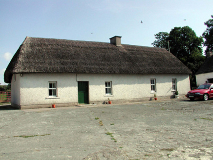 farm house496 yd
 CastleStructure · 1226 yd
 Clonea StrandBeach / strand · 1376 yd
 Horse-chestnut2.0 mi
 Cunnigar PointHeadland · 3.0 mi
 Dungarvan CastleCastle · 3.1 mi
 Dungarvan Castle (in Ruins)Castle, Anglo-Norman masonry castle · 3.1 mi
 Waterford County MuseumMuseum · 3.2 mi
 Grattan SquareVisitor information · 3.3 mi
 Erin's Hope 1867Memorial · 3.5 mi
Pictures: National Inventory of Architectural Heritage; Robert French, Wikimedia Commons · Public domain; Susan Pike, Geograph · CC BY-SA 2.0; Stephan van Helden, Wikimedia Commons · CC BY-SA 4.0; Colin Park, Geograph · CC BY-SA 2.0; Audrius Janecka, Wikimedia Commons · CC BY-SA 4.0; Oliver Dixon, Geograph · CC BY-SA 2.0; Slamforeman, Wikimedia Commons · CC BY 4.0; Alexander Redfern, Wikimedia Commons · CC BY-SA 4.0
More archaeology and monuments in County Waterford · All of County Waterford
What do you know about this place?