What is recorded here
Located in pasture on a slight rise in a level, low-lying landscape, with the canalised N-S Douglas stream c. 60m to the W. It is marked faintly as a two-cell structure on the 1840 ed. of the OS 6-inch map. There are no references to a castle here, although the land was owned by Theobald Fitzgerald in 1640 (Simington 1942, 76). Nothing is visible at ground level. Clonea church (WA031-037001-) is c. 240m to the NNE. Simington, R. C. (ed.) (1942) The Civil Survey AD 1654-1656, vi, the County of Waterford. Irish Manuscripts Commission. Dublin.
From the National Monuments Service (Archaeological Survey of Ireland) record WA031-038
The monument record does not grant public access. Check the route and ask the landowner before entering private land.
- What survives
- Recorded monument
Places near here
Grave YardGraveyard · 250 yd Historic buildingOfficially recorded historic building · 566 ydfarm house744 ydClonea StrandBeach / strand · 1181 ydCastleStructure · 1228 ydHorse-chestnut2.0 miCunnigar PointHeadland · 2.9 miDungarvan CastleCastle · 3.0 miDungarvan Castle (in Ruins)Castle, Anglo-Norman masonry castle · 3.0 miWaterford County MuseumMuseum · 3.2 miGrattan SquareVisitor information · 3.2 miErin's Hope 1867Memorial · 3.4 mi
 Historic buildingOfficially recorded historic building · 566 yd
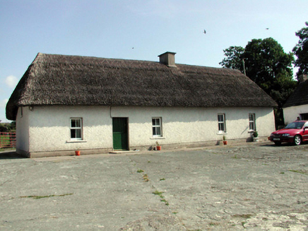 farm house744 yd
 Clonea StrandBeach / strand · 1181 yd
 CastleStructure · 1228 yd
 Horse-chestnut2.0 mi
 Cunnigar PointHeadland · 2.9 mi
 Dungarvan CastleCastle · 3.0 mi
 Dungarvan Castle (in Ruins)Castle, Anglo-Norman masonry castle · 3.0 mi
 Waterford County MuseumMuseum · 3.2 mi
 Grattan SquareVisitor information · 3.2 mi
 Erin's Hope 1867Memorial · 3.4 mi
Pictures: National Inventory of Architectural Heritage; Susan Pike, Geograph · CC BY-SA 2.0; Robert French, Wikimedia Commons · Public domain; Stephan van Helden, Wikimedia Commons · CC BY-SA 4.0; Colin Park, Geograph · CC BY-SA 2.0; Audrius Janecka, Wikimedia Commons · CC BY-SA 4.0; Oliver Dixon, Geograph · CC BY-SA 2.0; Slamforeman, Wikimedia Commons · CC BY 4.0; Alexander Redfern, Wikimedia Commons · CC BY-SA 4.0
More castles and forts in County Waterford · All of County Waterford
What do you know about this place?