
What is recorded here
Situated in the valley of the NW-SE River Blackwater with the NW-SE stream c. 50m to the NE. An early monastery (ME016-006----) was plundered by Vikings in AD 949 and by Dermot MacMurrough in 1170. The grass-grown remains of a structure (ext. dims 14.5m E-W; 7.5m N-S) are in a rectangular graveyard (dims c. 65m E-W; c. 45m N-S) defined by earthen banks and hedges. Three high crosses, the base of another, a cross slab and an ogham stone are displayed in the graveyard. (Harbison 1970, 180-1)
Compiled by: Michael Moore
Date of upload: 4 June, 2014
Situated in the valley of the NW-SE River Blackwater with the NW-SE stream c. 50m to the NE. An early monastery (ME016-006----) was plundered by Vikings in AD 949 and by Dermot MacMurrough in 1170. The grass-grown remains of a structure (ext. dims 14.5m E-W; 7.5m N-S) are in a rectangular graveyard (dims c. 65m E-W; c. 45m N-S) defined by earthen banks and hedges. Three high crosses, the base of another, a cross…
From the National Monuments Service (Archaeological Survey of Ireland) record ME016-006007
The monument record does not grant public access. Check the route and ask the landowner before entering private land.
- What survives
- Recorded monument
Places near here
 ChapelChurch · 15 yd
 CrossCross, High cross · 27 yd
 Hawthorn390 yd
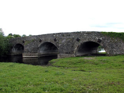 bridge870 ydMoatCastle, motte and bailey · 1.5 mi
 Standing stone in Balnagon UpperStanding stone · 1.6 miMaperathMountain / peak · 1.9 miThe Kieran Flanagan WayMemorial · 2.0 miGreat Famine ProjectMemorial · 2.1 miMountainpoleMountain / peak · 2.2 mi
 Sweet Chestnut3.6 mi
 Headfort HouseCastle · 4.4 mi
Pictures: RonanMcCormick, Wikimedia Commons · CC BY-SA 4.0; Didier Descouens, Wikimedia Commons · CC BY-SA 4.0; National Inventory of Architectural Heritage; Bob Embleton, Geograph · CC BY-SA 2.0; Miguel Angel Masegosa Martínez, Wikimedia Commons · CC BY 2.0; Robert Adam, Wikimedia Commons · Creative Commons Zero, Public Domain Dedication
More archaeology and monuments in County Meath · All of County Meath
What do you know about this place?