
Places near here
Photo credits
- National Inventory of Architectural Heritage
- Mike Searle, Wikimedia Commons · CC BY-SA 2.0
- Algirdas at Lithuanian Wikipedia, Wikimedia Commons · Public domain
- kevin higgins, Geograph · CC BY-SA 2.0
- Colin Park, Geograph · CC BY-SA 2.0
 Cuan MhuireGates/railings/walls · 1.1 mi
Explorer Tom Cuan Mhuire in Ballycarron is getting absolutely roasted by the seagulls who keep landing on those ornate Gibbsian…
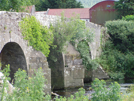 Cappa Old BridgeBridge · 1.5 mi
Explorer Tom Cappa Old Bridge in Cappauniac is a humpback bridge with stepped V-cutwaters that look like they were designed by an…
 Lismacue HouseCountry house · 1.7 mi
Explorer Tom Lismacue House in Bansha is a Gothic nightmare wrapped in early wallpaper, perfect for a zombie apocalypse survival…
 Cappa Castle (in ruins)Castle, tower house · 2.0 mi
Explorer Tom Cappa Castle would tell its younger self to stop worrying about the wind and start enjoying the view from the ridge.…
 Pedunculate Oak2.1 mi
Explorer Tom Pedunculate Oak in County Tipperary would probably have 'Finally Rested' on its tombstone, because it has been standing…
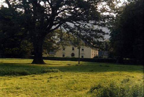 Ashgrove HouseHouse · 2.7 mi
Explorer Tom Ashgrove House inspired a really bad poem once that rhymed 'house' with 'mouse'. The owners have never quite forgiven…
 Ashgrove BridgeBridge · 2.9 mi
Explorer Tom Ashgrove Bridge in Ardane has such a humpback it could be a retired sumo wrestler taking a nap. Those fancy cut stone…
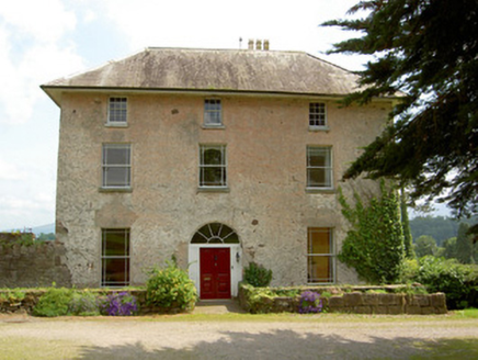 Cluen HouseHouse · 3.3 mi
Explorer Tom Cluen House in Cloonfinglass, County Tipperary once had the whole parish arguing about who owned which corner of the…
 Ardane National SchoolSchool · 3.7 mi
Explorer Tom Ardane National School has separate entrances for boys and girls, which feels like a time capsule from the nineteenth…
 KilshaneGate lodge · 3.9 mi
Explorer Tom Kilshane gate lodge is showing off its fancy bargeboards like it’s about to win a beauty contest. It’s got secret…
 FarbreagaMountain / peak · 5.5 mi
Explorer Tom Farbreaga sits on the eastern Galtee ridge in County Tipperary, a 724 metre summit that asks you to earn the view…
 GreenaneMountain / peak · 6.3 mi
Explorer Tom Greenane sounds like a hill that has never met a rainy day, which is a bold sales pitch for the Galtees. This 802 metre…
More archaeology and monuments in County Tipperary · All of County Tipperary

What do you know about this place?Tap to add a comment or ask a question