What is recorded here
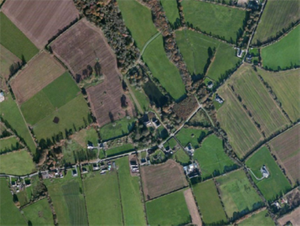
Situated on a slight E-facing slope. The parish church of Carnagh (WX035-035001-) is within a rectangular graveyard (dims. c. 55-70m E-W; c. 55m N-S) defined by earthen banks.
From the National Monuments Service (Archaeological Survey of Ireland) record WX035-035002
The monument record does not grant public access. Check the route and ask the landowner before entering private land.
- What survives
- Recorded monument
Places near here
Photo credits
- National Inventory of Architectural Heritage
- Mike Searle, Wikimedia Commons · CC BY-SA 2.0
- David Purchase, Wikimedia Commons · CC BY-SA 2.0
- seegraswiese, Wikimedia Commons · CC BY-SA 3.0
- Richard Webb, Geograph · CC BY-SA 2.0
- Ryanforsyth9, Wikimedia Commons · CC BY-SA 4.0
- Hywel Williams, Geograph · CC BY-SA 2.0
- Paul O'Farrell, Geograph · CC BY-SA 2.0
- Oliver Dixon, Geograph · CC BY-SA 2.0
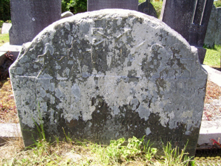 graveyard/cemetery6 yd
 Carnagh HouseCountry house · 165 yd
_-_geograph.org.uk_-_7608906.jpg/250px-Castles_of_Leinster,_Tellarought,_Wexford_(1)_-_geograph.org.uk_-_7608906.jpg "Photo: Mike Searle, Wikimedia Commons · CC BY-SA 2.0") Castle (in ruins)Castle, tower house · 1.3 mi
Castle (in ruins)Castle, tower house · 1.3 mi SlievecoiltiaMountain / peak · 3.1 mi
 Devon whitebeam3.7 mi
 Carrickbyrne HillMountain / peak · 3.8 mi
 1798 MonumentMonument · 3.9 mi
 Forest Of The DunbrodyForest · 4.2 mi
_(geograph_5442502).jpg/250px-Castles_of_Leinster-_Adamstown,_Wexford_(1)_(geograph_5442502).jpg "Photo: Mike Searle, Wikimedia Commons · CC BY-SA 2.0") Castle (in ruins)Castle, tower house · 7.0 mi
Castle (in ruins)Castle, tower house · 7.0 mi Grange BeachBeach / strand · 9.7 mi
 Blackhall StrandBeach / strand · 10 mi
 Windmill11 mi
More archaeology and monuments in County Wexford · All of County Wexford
What do you know about this place?