
Places near here
Photo credits
- Kenneth Allen, Geograph · CC BY-SA 2.0
- National Inventory of Architectural Heritage
- Alvesgaspar, Wikimedia Commons · CC BY-SA 3.0
- Malene Thyssen, Wikimedia Commons · CC BY-SA 3.0
- Kenneth Allen, Wikimedia Commons · Creative Commons Attribution-ShareAlike 2.0
- Wanfried-Dublin, Wikimedia Commons · CC0
- Jonathan Billinger, Wikimedia Commons · CC BY-SA 2.0
 Killycluggin StoneVisitor information · 443 yd
Explorer Tom Killycluggin Stone in County Cavan makes a spooky knocking sound at night that is definitely just the wind being rude.…
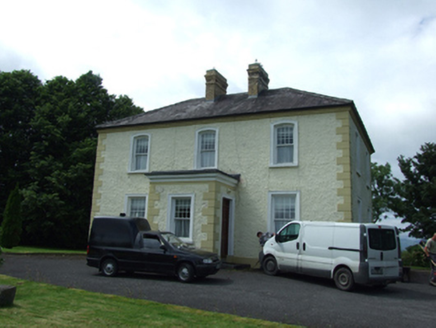 The PresbyteryPresbytery/parochial/curate's house · 527 yd
Explorer Tom The Presbytery in Kilnavert is a sober classical box for priests who needed somewhere to hide from their parishioners.…
Tober PatrickHoly well · 578 ydExplorer Tom Tober Patrick in Corran would be a terrible history teacher because it keeps spilling water over its notes every single…
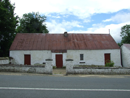 farm house594 yd
Explorer Tom Farm house in Kilnavert is a traditional thatched hearth-lobby plan with an outhouse under the same roof, which means…
LissanoverCastle, unclassified · 1038 ydExplorer Tom Lissanover is a tower that passes itself off as a castle with confidence. It was granted to Bryan McShane O’Reilly, who…
Saint Mogue's IslandIslet · 1.4 miExplorer Tom Saint Mogue's Island in County Cavan claims to be older than the concept of time itself, which is a bold claim for…
 Common Lime1.5 mi
Explorer Tom Common Lime in County Cavan has a name that really means 'The Tree That Judges Your Posture' if you ask me. I made that…
 European Beech1.6 mi
Explorer Tom European Beech in County Cavan has an imaginary twin across the sea that they argue with via telepathy. They probably…
 IndicatedCastle, tower house · 2.1 mi
Explorer Tom Castle in Ballymagauran writes on its dating profile: 'Two stories tall, good bones, need a roof'. It's got a splayed…
.jpg/250px-Doon_(0).jpg "Photo: Wanfried-Dublin, Wikimedia Commons · CC0") Court tomb in Doon (ballyconnell Ed)Court tomb · 3.2 mi
Court tomb in Doon (ballyconnell Ed)Court tomb · 3.2 miExplorer Tom Court tomb in Doon is dual-chambered and overgrown with bushes, like it’s trying to hide from the public eye. It’s got…
 Evlagh MoreMountain / peak · 3.5 mi
Explorer Tom Evlagh More in County Cavan rates visitors based on how loudly they complain about the wind. Last week a tourist gave…
 Slieve RushenMountain / peak · 4.3 mi
Explorer Tom Slieve Rushen has a family tree that is mostly made up by local grandmothers who enjoy gossiping. The real history is…
More archaeology and monuments in County Cavan · All of County Cavan

What do you know about this place?Tap to add a comment or ask a question