
What is recorded here
From OpenStreetMap (© OpenStreetMap contributors) w391807595
Places near here
Photo credits
- Maker not stated on source page, en.wikipedia.org
- Maker not stated on source page, tr.pinterest.com
- Maker not stated on source page, heritageireland.ie
- Maker not stated on source page, commons.wikimedia.org
- Maker not stated on source page, www.shutterstock.com
- Maker not stated on source page, www.ampersandtravel.com
- Maker not stated on source page, www.tripadvisor.com.au
- Colin Park, Geograph · CC BY-SA 2.0
- Maker not stated on source page, www.flickr.com
- Maker not stated on source page, www.pinterest.com
 Church in Grangeford OldChurch · 167 yd
Explorer Tom Church in Grangeford Old would be the guy at the wedding who refuses to leave the bar and starts arguing with the DJ…
 Site of Fardarraghnagranshy's CastleArchaeological place · 563 yd
Explorer Tom Site of Fardarraghnagranshy's Castle in County Carlow would absolutely order the whole chip shop menu and then complain…
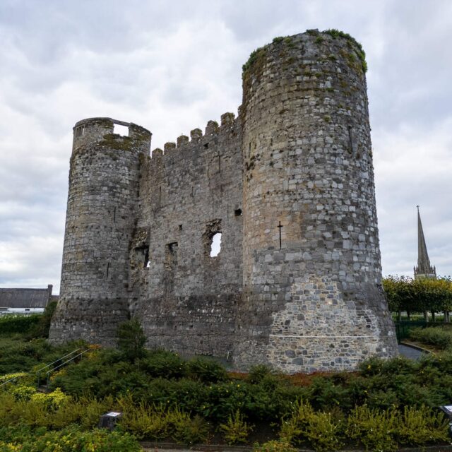 Site of Fardurraghnagransbys CastleCastle, unclassified · 565 yd
Explorer Tom Site of Fardurraghnagransbys Castle in Grangeford got into a row with the next village over who had the better mud, and…
 Earthwork in RathbaunEarthwork · 1274 yd
Explorer Tom Earthwork in Rathbaun is an oval wooded area that looks like it’s taking a nap. If it were a person at a wedding, it’d…
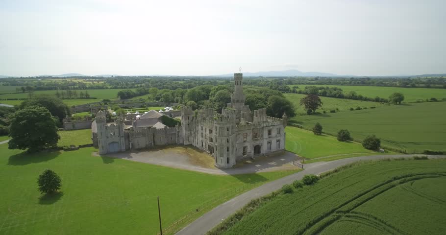 Friarstown Castle (in ruins)Enclosure · 1463 yd
Explorer Tom Friarstown Castle is having a fairy dispute over parking rights because there are more fairies than spots in its little…
 CastleCastle, unclassified · 1.4 mi
Explorer Tom Castle in Killenora is a possible castle that is currently having a very strong opinion about being 'possibly' anything…
 Church (Site of)Church · 1.9 mi
Explorer Tom Church in Ardnehue has no visible trace, so it’s basically a ghost with commitment issues. I bet it hears the wind…
 Site of Church & Grave YardGraveyard · 1.9 mi
Explorer Tom Site of Church & graveyard in Ardnehue has vanished so completely that even the map forgot it existed. It’s like a…
 Duckett's GroveGate lodge · 2.2 mi
Explorer Tom Duckett’s Grove is a gate lodge with castellated entrances and armorial devices, designed by J. McDuff Derick in 1845.…
 Ballinakelly WoodForest · 3.1 mi
Explorer Tom Ballinakelly Wood is refusing to fall down because it thinks gravity is just a suggestion for trees. It stands there…
 Gilbertstown Church (in ruins), GraveyardChurch · 3.7 mi
Explorer Tom Gilbertstown Church, Graveyard in Gilbertstown has faint traces of a foundation, which is polite for 'mostly gone'. A…
 Gilbertstown GraveyardGraveyard · 3.7 mi
Explorer Tom Gilbertstown Graveyard has an imaginary fan club that meets every Tuesday to discuss its lawn maintenance. They are…
More archaeology and monuments in County Carlow · All of County Carlow

What do you know about this place?Tap to add a comment or ask a question