Places near here
Photo credits
- National Inventory of Architectural Heritage
- liam murphy, Geograph · CC BY-SA 2.0
- Algirdas at Lithuanian Wikipedia, Wikimedia Commons · Public domain
- liam murphy, Geograph · Creative Commons Attribution-ShareAlike 2.0
- liam murphy, Wikimedia Commons · CC BY-SA 2.0
- Hello, I am Bruce on Flickr, Wikimedia Commons · CC BY-SA 2.0
- Colin Park, Geograph · CC BY-SA 2.0
- Elliot Tucker, Wikimedia Commons · CC BY-SA 4.0
- Poleary91, Wikimedia Commons · CC BY-SA 4.0
- Jonathan Billinger, Wikimedia Commons · CC BY-SA 2.0
- Smirkybec, Wikimedia Commons · CC BY-SA 4.0
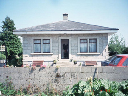 Kilknock HouseGate lodge · 1.0 mi
Explorer Tom Kilknock House is just the gate lodge; the main house got demolished in 1940 and never apologised. This granite guy with bow windows is now the landlord of its own graveyard. Bring your worst joke, the place has heard worse from the ghosts.
 Church (in ruins), GraveyardChurch · 1.3 mi
Explorer Tom Church, Graveyard in Templepeter is a simple rectangular structure made of large granite boulders that aren’t cored, so they’re just hanging out. It’s aligned East-West, which means it’s facing the right way for no reason. Toast it with a cup of tea and move on to the next.
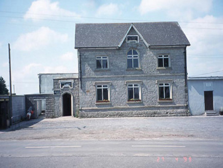 school master's house1.5 mi
Explorer Tom The school master's house in Rathtoe is now a Credit Union, which means the kids are gone and the money is here. A proper spot for a flask of tea and a big think about where the homework went.
 Pedunculate Oak2.9 mi
Explorer Tom This Pedunculate Oak in County Carlow gave up coffee for Lent because it was getting too jittery. It's now just vibrating with ancient energy. It's free, it's odd, what more do you want from a tree?
 Graveyard3.0 mi
Explorer Tom Graveyard in Ardristan is square-shaped and has a church right in the middle, like it's trying to hold everything together. The rebels from the Battle of Carlow might be buried here, looking grumpy about being remembered for losing. Bring a camera and your most suspicious face, they love that energy.
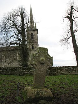 CrossCross, High cross · 4.0 mi
Explorer Tom Nurney High Cross is well-preserved with rope mouldings and a boss, looking fancy. The hero who saved it was probably just a very drunk farmer in 1890s. Give it a pat on the way past, it's had a long life.
 Scots Pine4.8 mi
Explorer Tom Scots Pine in County Carlow is holding a secret that would make sense if I had three more pints. It might be about a missing shoe or a bad date. Go on, count the windows and get it wrong like I did.
 Altamont Gardens MapVisitor information · 4.8 mi
Explorer Tom Altamont Gardens Map in County Carlow would bring its own compass to a party and still get lost. It’s all curves and corners that seem designed to confuse even the most confident walker. If it rains, blame me.
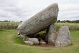 Brownshill Portal TombVisitor information · 5.2 mi
Explorer Tom Brownshill Portal Tomb in County Carlow would rate its visitors two stars for lack of imagination and too many selfie sticks. It’s seen it all over the millennia and isn’t impressed by your new shoes. Ideal spot for a dramatic phone call.
 Ballymoon Castle (in ruins)Castle, Anglo-Norman masonry castle · 6.0 mi
Explorer Tom Ballymoon Castle in County Carlow is doing a bit of a disappearing act for you. Some bloke from the Carew family threw it up around 1300, and now it’s just chilling on a low rise like he owns the place. Give that square courtyard a proper wave!
 Battle of CarlowBattle · 6.4 mi
Explorer Tom Battle of Carlow in County Carlow nearly became famous for having nothing happen at all, which is quite the achievement. It’s basically a great big field that refuses to pick a side, ever. Perfect spot to practise your best tour-guide voice.
 Carlow County MuseumMuseum · 6.4 mi
Explorer Tom Carlow County Museum is whispering secrets through its walls that only the very quiet can hear. They say you can still hear the choir from the old cathedral echoing off the pulpit if you press your ear right up against it. Look serious, nod slowly, you're basically an expert now.
More memorials and graveyards in County Carlow · All of County Carlow

What do you know about this place?Tap to add a comment or ask a question