
Places near here
Photo credits
- National Inventory of Architectural Heritage
- Graham Horn, Wikimedia Commons · CC BY-SA 2.0
- Golfing in Ireland; photographer not stated, Source publisher
- Gordon Hatton, Geograph · CC BY-SA 2.0
- Chris, Geograph · CC BY-SA 2.0
- Simon Huguet, Wikimedia Commons
- Roger Diel, Geograph · CC BY-SA 2.0
- Kmcnamee, Wikimedia Commons · CC BY-SA 4.0
 Honan's BridgeBridge · 2.0 mi
Explorer Tom Honan's Bridge in Glendine South, County Clare, is an old single-arch bridge from 1872 that probably thinks it’s too…
 Saint Joseph's Catholic ChurchChurch/chapel · 2.0 mi
Explorer Tom Saint Joseph's Catholic Church in Cloonbony has a broach spire added in 1863 that looks like a party hat for a…
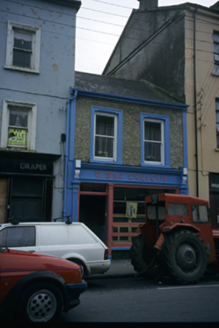 D. Mac CruitínHouse · 2.1 mi
Explorer Tom D. Mac Cruitín is a house with a shopfront that looks like it’s waiting for a celebrity to sign its pebbledash walls.…
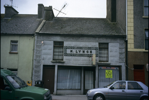 M. LynchHouse · 2.2 mi
Explorer Tom M. Lynch in Leagard South is a house named after a person, which feels personal and slightly awkward to visit. It was…
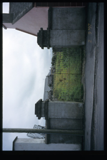 graveyard/cemetery2.2 mi
Explorer Tom Leagard South graveyard in Leagard South has had bodies in it since 1802, which is a long time for a quiet…
 Spanish Point Golf ClubGolf course · 3.3 mi
 Cream PointHeadland · 3.5 mi
Explorer Tom Cream Point would survive a zombie attack simply by being too delicious for them to ignore at first. They’d get…
 Spanish PointVisitor information · 3.7 mi
Explorer Tom Sightseeing Cliffs of Moher South has a real opinion on tourists from Dublin, thinking they’re all a bit too eager to…
 Spanish Point BeachVisitor attraction · 3.9 mi
Explorer Tom Spanish Point Beach curves around Mal Bay in west Clare, and Tom has decided the Atlantic is putting on a surf show…
 Caherrush Castle (in Ruins)Castle, tower house · 4.8 mi
Explorer Tom Caherrush Castle is probably being run by a fox who thinks he’s the landlord. It’s a tower house that’s seen better…
 Liscannor GAA pitchGAA ground · 6.0 mi
 Tromra CastleCastle, tower house · 6.8 mi
Explorer Tom Tromra Castle overlooks Mutton Island from level marshy ground, which sounds like a bad dream. The wind probably picked…
More archaeology and monuments in County Clare · All of County Clare

What do you know about this place?Tap to add a comment or ask a question