
What is recorded here
On level marshy ground overlooking Mutton Island to the NW. A rectangular tower (int. dims. 6.8m NW-SE; 6.6m NE-SW) of three floors constructed of coursed local flagstone with a base-batter (max. H c. 22m). The damaged entrance (bolt-hole evident at SW) towards the S end of the SE side leads directly to the ground floor chamber under a damaged NW-SE vault which has embrasures (Wth 1.35m; H 1.65) in the NW and NE walls, now broken through as entrances, and there is a cupboard at the N end of the SE wall. A damaged doorway at the E angle led by a spiral stairs to the first floor under a damaged NW-SE vault with wicker centering. This floor has large windows (Wth 0.4m) in embrasures in the NE (Wth 1.8m; H 2m) and NW (Wth 1.6m; H 1.75) walls. There is a garderobe with two lights in the NW wall, and the destroyed fireplace is in the SW wall. The third floor is inaccessible, but has a garderobe in the NW wall and large ogee-headed windows with hollow spandrels in each wall, that on the NW being complete. There are additional lights in the SE and SW walls, and the stairs housing rises over the NE angle. Three corbels remaining on the outer SE corner may have supported a bartizan. (Ua Cróinín and Breen 1997)
The following has been attached:
CL038-006----_)1.pdf Details from Risteárd Ua Cróinín and Martin Breen, The Castles and Tower-houses of Co. Clare (unpublished report). Uploaded courtesy of R. Ua Cróinín and M. Breen.
On level marshy ground overlooking Mutton Island to the NW. A rectangular tower (int. dims. 6.8m NW-SE; 6.6m NE-SW) of three floors constructed of coursed local flagstone with a base-batter (max. H c. 22m). The damaged entrance (bolt-hole evident at SW) towards the S end of the SE side leads directly to the ground floor chamber under a damaged NW-SE vault which has embrasures (Wth 1.35m; H 1.65) in the NW and NE…
From the National Monuments Service (Archaeological Survey of Ireland) record CL038-006
The monument record does not grant public access. Check the route and ask the landowner before entering private land.
- What survives
- Recorded monument
Places near here
White Point FortEnclosure, large enclosure · 611 yd Seafield North BeachBeach / strand · 1186 ydLurga PointHeadland · 1744 ydCatholic Church of Our Lady Star of the SeaChurch/chapel · 1.0 miEmlagh PointHeadland · 1.7 miMutton IslandIsland · 2.2 miCaherrush Castle (in Ruins)Castle, tower house · 2.3 miSaint Mary's Roman Catholic ChurchChurch/chapel · 2.4 miSpanish Point BeachBeach / strand · 3.0 miDoughmore BeachBeach / strand · 3.3 miSpanish PointVisitor information · 3.3 miDoonmore Castle (in Ruins)Castle, tower house · 5.0 mi
 Seafield North BeachBeach / strand · 1186 yd
 Lurga PointHeadland · 1744 yd
 Catholic Church of Our Lady Star of the SeaChurch/chapel · 1.0 mi
 Emlagh PointHeadland · 1.7 mi
 Mutton IslandIsland · 2.2 mi
 Caherrush Castle (in Ruins)Castle, tower house · 2.3 mi
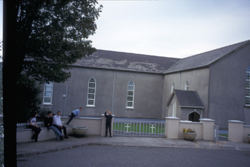 Saint Mary's Roman Catholic ChurchChurch/chapel · 2.4 mi
 Spanish Point BeachBeach / strand · 3.0 mi
 Doughmore BeachBeach / strand · 3.3 mi
 Spanish PointVisitor information · 3.3 mi
 Doonmore Castle (in Ruins)Castle, tower house · 5.0 mi
Pictures: Richard cattel, Geograph · CC BY-SA 2.0; Gordon Hatton, Geograph · CC BY-SA 2.0; The Banner, Wikimedia Commons · CC BY-SA 3.0; Simon Huguet, Wikimedia Commons · CC BY-SA 2.0; Charles W Glynn, Wikimedia Commons · CC BY-SA 2.0; Roger Diel, Geograph · CC BY-SA 2.0; National Inventory of Architectural Heritage; GenesisNZ, Wikimedia Commons · CC BY-SA 4.0; Charles W Glynn, Geograph · CC BY-SA 2.0; Chris, Geograph · CC BY-SA 2.0
More castles and forts in County Clare · All of County Clare
What do you know about this place?