What is recorded here
At the N edge of a terrace overlooking the sea c. 1km to N. Listed as 'enclosure' in the SMR (1992) and the RMP (1996). A circular grass-covered area (int. diam. 76m E-W; 70m N-S) defined by an earthen bank (Wth 2.6-4m; int. H 0.6-1.2m; ext. H 1.3-1.8m) which is incorporated into a field bank S-NNW. There is no visible fosse and no entrance other than a modern one at S. A hut site (CL038-005002-) is slightly to E of centre.
At the N edge of a terrace overlooking the sea c. 1km to N. Listed as 'enclosure' in the SMR (1992) and the RMP (1996). A circular grass-covered area (int. diam. 76m E-W; 70m N-S) defined by an earthen bank (Wth 2.6-4m; int. H 0.6-1.2m; ext. H 1.3-1.8m) which is incorporated into a field bank S-NNW. There is no visible fosse and no entrance other than a modern one at S. A hut site (CL038-005002-) is slightly to E…
From the National Monuments Service (Archaeological Survey of Ireland) record CL038-005
The monument record does not grant public access. Check the route and ask the landowner before entering private land.
- What survives
- Recorded monument
Places near here
 Seafield North BeachBeach / strand · 600 yd
 Tromra CastleCastle, tower house · 611 yd
 Lurga PointHeadland · 1135 yd
 Catholic Church of Our Lady Star of the SeaChurch/chapel · 1.0 mi
 Emlagh PointHeadland · 1.6 mi
 Mutton IslandIsland · 1.9 mi
 Caherrush Castle (in Ruins)Castle, tower house · 2.3 mi
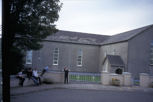 Saint Mary's Roman Catholic ChurchChurch/chapel · 2.7 mi
 Spanish Point BeachBeach / strand · 3.0 mi
 Spanish PointVisitor information · 3.3 mi
 Doughmore BeachBeach / strand · 3.4 mi
 Freagh IslandIslet · 5.2 mi
Pictures: Richard cattel, Geograph · CC BY-SA 2.0; Roger Diel, Geograph · CC BY-SA 2.0; Gordon Hatton, Geograph · CC BY-SA 2.0; The Banner, Wikimedia Commons · CC BY-SA 3.0; Simon Huguet, Wikimedia Commons · CC BY-SA 2.0; Charles W Glynn, Wikimedia Commons · CC BY-SA 2.0; National Inventory of Architectural Heritage; GenesisNZ, Wikimedia Commons · CC BY-SA 4.0; Chris, Geograph · CC BY-SA 2.0; Charles W Glynn, Geograph · CC BY-SA 2.0
More archaeology and monuments in County Clare · All of County Clare
What do you know about this place?