What is recorded here
A ruined castle at Killaghan is depicted on the Strafford map of c. 1636 (Simington 1949, Athlone (263)) and Sir Luke Dillon of Lough Glynn (RO020-003001-) owned 256 acres there in 1641. He also owned over 1300 acres elsewhere in St John’s parish, which the family retained through the Cromwellian settlement (ibid.…
Read the whole record
From the National Monuments Service (Archaeological Survey of Ireland) record RO045-107001
Places near here
Photo credits
- Maker not stated on source page, www.thejournal.ie
- Maker not stated on source page, commons.wikimedia.org
- Maker not stated on source page, uk.pinterest.com
- Maker not stated on source page, irishheritagenews.ie
- Maker not stated on source page, www.irishtimes.com
- Maker not stated on source page, www.pinterest.com
- Maker not stated on source page, en.wikipedia.org
- Maker not stated on source page, global-geography.org
- National Inventory of Architectural Heritage
 Enclosure in BinmuckEnclosure · 772 yd
Explorer Tom Binmuck’s enclosure once heard a prophecy that it would become a nightclub, but it settled for being a collapsed wall…
 Saint John's CemeteryCemetery · 877 yd
Explorer Tom Saint John's Cemetery in County Roscommon is stuck in a feud with the O'Malley family over who has the best view. It’s…
 Fairy fort / stone ringfort in Carnagh WestFairy fort / stone ringfort · 1011 yd
Explorer Tom Fairy fort / stone ringfort in Carnagh West is sick of everyone asking if the fairies left their wallets behind inside…
 Fairy fort / earthen ringfort in Carrigan MoreFairy fort / earthen ringfort · 1013 yd
Explorer Tom Fairy fort / earthen ringfort in Carrigan More is actually named after a man who tripped over it and broke his nose.…
 Fairy fort / earthen ringfort in BallybroganFairy fort / earthen ringfort · 1453 yd
Explorer Tom Fairy fort / earthen ringfort in Ballybrogan in County Roscommon is listening so hard through its thick walls that it…
Fairy fort / earthen ringfort in ToberdanFairy fort / earthen ringfort · 1.1 miExplorer Tom Fairy fort in Toberdan has a secret talent for being almost invisible on old maps. It’s sitting on a hill crest…
 Cist in ToberdanCist · 1.3 mi
Explorer Tom Cist in Toberdan has one very specific least favourite visitor: anyone who talks too loudly about their weekend plans.…
 Memorial stone in ToberdanMemorial stone · 1.4 mi
Explorer Tom Memorial stone in Toberdan commemorates Peter and Mary Kelly, who likely died because they argued too loudly about who…
 Megalithic structure in KnockanyconorMegalithic structure · 1.5 mi
Explorer Tom Megalithic structure in Knockanyconor has the weather holding a long grudge against it. It’s a tiny cist next to a…
 Portal tomb in KnockanyconorPortal tomb · 1.5 mi
Explorer Tom Portal tomb in Knockanyconor is a love story that went horribly wrong next door, with the roofstone barely resting on…
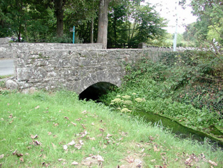 Historic buildingOfficially recorded historic building · 1.6 mi
Explorer Tom Historic building in Knockanyconor is basically a bridge that had a dance party with a mill stream and went way too…
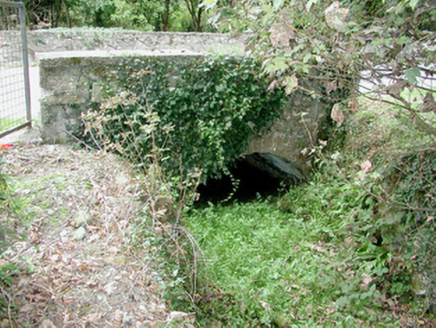 bridge1.6 mi
Explorer Tom Bridge in Knockanyconor was built by a guy who thought arches were overrated but then changed his mind halfway through…
More historic places in County Roscommon · All of County Roscommon

What do you know about this place?Tap to add a comment or ask a question