What is recorded here
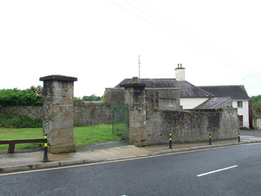
Pair of square-profile gate piers, built c.1760, formerly providing entrance to barracks. Sandstone ashlar on raised plinths with projecting capping, full-height recess to take gates on opening side to rear of piers. Original gates replaced by lower historic forged-iron double gates of later date. Rubble stone wall abutting north side connecting to former officer’s house, no surviving wall to south side. Concrete watch hut to inside of north wall with metal frame window and timber door. Opens directly onto street to western side of Barrack Hill.
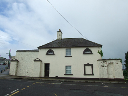
A gateway to a former cavalry barracks, remnants of which survive as a ruin to the north. The gates provide context to the former officer’s house on Barrack Hill which stands north of the gates. The barracks were arranged around a large exercise yard and accommodated a hospital, stables and soldiers accommodation. The entrance and officer's house are interesting surviving elements of the military history of Belturbet, providing insight into local social and political history.
From the Buildings of Ireland (National Inventory of Architectural Heritage) record 40307011
This does not grant access. Most recorded buildings are privately owned; view them only from public ground unless the owner allows entry.
Places near here
Photo credits
- National Inventory of Architectural Heritage
- Deadstar, Wikimedia Commons · CC BY-SA 4.0
- Kenneth Allen, Geograph · CC BY-SA 2.0
 officer's house22 yd
 Erne Palais BallroomCinema · 129 ydBomb Victims MemorialMemorial · 473 yd
 Mill WalkVisitor information · 663 ydBastioned fort in Corporation LandsBastioned fort · 682 yd
 Welcome to Belturbet StationVisitor information · 702 yd
 Belturbet Heritage Railway Station MuseumMuseum · 707 yd
 Belturbet Railway Station Visitor CentreHeritage attraction · 721 ydSit of CastleCastle, motte and bailey · 870 ydTurbet IslandWood · 872 ydTurbet Island Castle Motte and BaileyArchaeological place · 874 yd
 Putiaghan Lower ForestForest · 1.3 mi
More historic places in County Cavan · All of County Cavan
What do you know about this place?