
What is recorded here
Detached six-bay double-height primary school, dated 1956, having pair of projecting two-bay blocks flanking three-bay entrance to front (north-west). Recent extension to side (south-west). Pitched slate roof with central roughcast rendered chimneystack, rendered eaves and cast-iron rainwater goods. Flat bitumen clad roof to front section. Roughcast rendered walls with rendered plinth, carved limestone date plaque to front elevation pitched roofed block. Square-headed window openings with rendered sills, having six-over-six pane timber-sliding sash windows to front block. Tripartite timber casement windows to front elevation of pitched roofed block, having replacement aluminium casement windows to rear (south-east) elevation. Square-headed door openings, having timber battened door to front porch surmounted by rendered canopy, opening to concrete steps. Timber battened door to rear elevation within open flat-roofed porch, comprising concrete columns and canopy. Single-storey bitumen clad flat-roofed shelter to south-east of schoolyard having concrete columns front. Attached square-profile water tower to north-east with flat bitumen roof and roughcast rendered walls. Roughcast rendered walls and square-profile piers with steel gates and railings to front of site.
The form of this school is typical of national schools which were built following the foundation of the Irish Free State. This recognisable form and plan, with strong horizontality expressed by the use of flat roofs, was utilised by the Board of Works throughout Ireland. This school is unusual in that it retains many of its original features and materials such as timber sash windows, stone date plaque, concrete shelter and water tower.
From the Buildings of Ireland (National Inventory of Architectural Heritage) record 20908508
This does not grant access. Most recorded buildings are privately owned; view them only from public ground unless the owner allows entry.
Places near here
Charlie Hurley MemorialMemorial · 920 yd Belrose HouseCountry house · 1499 ydGrave YardGraveyard · 1.3 miDesertmore HouseRectory/glebe/vicarage/curate's house · 1.7 miSunday WellSpring · 2.2 miBi-Centenary of 1798Memorial · 2.3 miGrange HillMountain / peak · 2.4 miGrave YardGraveyard · 3.4 miKilcrea Castle (in Ruins)Castle, tower house · 3.5 miKilcrea CastleWood · 3.5 miBallincollig CastleCastle · 4.2 miMonterey Cypress4.5 mi
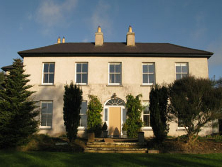 Belrose HouseCountry house · 1499 yd
 Grave YardGraveyard · 1.3 mi
 Desertmore HouseRectory/glebe/vicarage/curate's house · 1.7 mi
 Sunday WellSpring · 2.2 miBi-Centenary of 1798Memorial · 2.3 miGrange HillMountain / peak · 2.4 mi
 Grave YardGraveyard · 3.4 mi
 Kilcrea Castle (in Ruins)Castle, tower house · 3.5 mi
 Kilcrea CastleWood · 3.5 mi
 Ballincollig CastleCastle · 4.2 mi
 Monterey Cypress4.5 mi
Pictures: National Inventory of Architectural Heritage; Hywel Williams, Geograph · CC BY-SA 2.0; Neville Goodman, Wikimedia Commons · CC BY-SA 2.0; Hywel Williams, Geograph · Creative Commons Attribution-ShareAlike 2.0; Jonathan Thacker, Geograph · CC BY-SA 2.0; Richard Fensome, Wikimedia Commons · CC BY-SA 2.0; Brendandiamond, Wikimedia Commons · CC BY-SA 3.0; Vadim Manuylov, Wikimedia Commons · CC BY-SA 3.0
More historic places in County Cork · All of County Cork
What do you know about this place?