
Places near here
Photo credits
- PAUL FARMER, Geograph · Creative Commons Attribution-ShareAlike 2.0
- Espresso Addict, Wikimedia Commons · CC BY-SA 2.0
- Colin Park, Wikimedia Commons · CC BY-SA 2.0
- Colin Park, Geograph · CC BY-SA 2.0
- Mat Tuck, Wikimedia Commons · CC BY-SA 2.0
- Tatania Gerus, Wikimedia Commons · CC BY 2.0
- bertknot from scarborough, australia, Wikimedia Commons · CC BY-SA 2.0
- Dennis Turner, Geograph · CC BY-SA 2.0
- Jose Antonio Gutierrez D., Wikimedia Commons · CC BY-SA 4.0
 Blackstones BridgeBridge · 1.6 mi
Explorer Tom Blackstones Bridge would tell its younger self to stop worrying about the V-cutwaters and just flow. Four arches of…
 CurraghmoreMountain / peak · 4.0 mi
Explorer Tom Curraghmore is the lonely south-western shoulder of Kerry's MacGillycuddy's Reeks, rising above Lough Acoose with Caher…
 Caher West TopMountain / peak · 4.0 mi
Explorer Tom Caher West Top in County Kerry used to be a smuggling route but the smugglers got tired of carrying rocks that weren't…
 CaherMountain / peak · 4.2 mi
Explorer Tom Caher reaches a neat 1,000 metres, as if Kerry wanted a tidy number for Ireland's third-highest mountain. It stands…
 BeannMountain / peak · 4.9 mi
Explorer Tom Beann is a short name for a long day in Kerry's Dunkerron Mountains. The narrow grassy ridge above the hollow called…
 BroaghnabinniaMountain / peak · 5.1 mi
Explorer Tom Broaghnabinnia in County Kerry got into a fairy dispute over parking rights and lost, so now it sits sulking near the…
 Stumpa Duloigh se TopMountain / peak · 5.2 mi
Explorer Tom Stumpa Duloigh se Top claims a local invented it just to confuse tourists who can’t read maps. He swears he drew it…
 Kilmore Church (Valencia)Church/chapel · 20 mi
Explorer Tom Kilmore Church in Farranreagh would tell its younger self to stop worrying about the roof leaking. It’s all about…
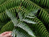 Silver tree fern20 mi
Explorer Tom Silver tree fern in County Kerry is strutting around like it invented the word 'majestic'. Some poor soul once wrote a…
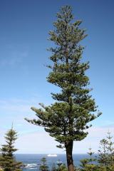 Norfolk Island Araucaria20 mi
Explorer Tom A Norfolk Island Araucaria in County Kerry is shaped like a shortcut that leads you right back to where you started.…
 Cromwell PointHeadland · 20 mi
Explorer Tom Cromwell Point ended up in County Kerry after getting lost on a very long walk from London, and it’s been stuck ever…
 Wedge tomb in An Com (bar. Uíbh Ráthach)Wedge tomb · 23 mi
Explorer Tom Wedge tomb in An Com thinks one massive roof stone makes it look cool and mysterious. A goat used to rule this place…
More archaeology and monuments in County Kerry · All of County Kerry

What do you know about this place?Tap to add a comment or ask a question