
Places near here
Photo credits
- National Inventory of Architectural Heritage
- Rick Crowley, Geograph · CC BY-SA 2.0
- Podstawko, Wikimedia Commons · CC BY-SA 4.0
- Andy Beecroft, Geograph · CC BY-SA 2.0
- Picture: The Boathouse Gallery
- Christopher Michel, Wikimedia Commons
- Garry Dickinson, Geograph · CC BY-SA 2.0
- Mike Searle, Wikimedia Commons · CC BY-SA 2.0
- Andy Beecroft, Wikimedia Commons · CC BY-SA 2.0
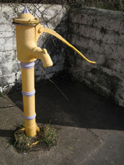 water pump521 yd
Explorer Tom Water pump in Knocknapogaree is a cast-iron relic from 1870 that isn’t working anymore but looks fancy with its cow…
 Charles FortBarracks · 1268 yd
Explorer Tom Charles Fort in Forthill has soldier's quarters built right into the ramparts. It’s a star-shaped fort, which is cool…
 Charlesfort LighthouseLighthouse · 1399 yd
Explorer Tom Charlesfort Lighthouse in County Cork has an imaginary twin across the sea that they talk to every night, sharing…
 The Old Post HouseHouse · 1449 yd
Explorer Tom The Old Post House in Bawnavota would teach history by shouting about how many letters it never delivered because they…
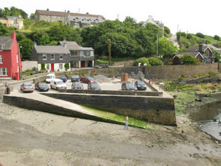 quay/wharf1472 yd
Explorer Tom Quay or wharf in Ardbrack is right next to Charles Fort, which makes it feel really important. It’s been singing…
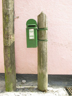 post box1485 yd
Explorer Tom Post box in Ardbrack is covered in Gaelic script that probably sounds like a fiddle playing all night. It’s simple…
 Kinsale HarbourBay · 1.0 mi
Explorer Tom Kinsale Harbour is hiding a secret message in its stones, allegedly written by a fisherman who got fed up of waiting…
 The Boathouse GalleryGallery · 1.9 mi
Explorer Tom At 68 Main Street in Kinsale, the Boathouse Gallery has pulled off a tidy trick: a building erected as a steam bakery…
.jpg/250px-Kinsale_(4693044621).jpg "Photo: Christopher Michel, Wikimedia Commons") KinsaleHistoric town · 1.9 mi
KinsaleHistoric town · 1.9 miExplorer Tom You might call Kinsale picturesque. The harbour once called it strategic. Kinsale is a town built around a harbour that…
 Ringrone Castle (in Ruins)Castle, tower house · 2.0 mi
Explorer Tom Ringrone Castle in Castlelands, County Cork is just a fragment of a wall overlooking the Bandon river. Built by the de…
 Ringrone CastleCastle · 2.0 mi
Explorer Tom Ringrone Castle is just a wall standing by itself near the Bandon river. Myles De Courcey built it in 1225, and the…
 Sandy Cove IslandIslet · 2.1 mi
Explorer Tom Sandy Cove Island has a local who swears he invented the whole place with a shovel and some sand. It's free, it's odd…
More archaeology and monuments in County Cork · All of County Cork

What do you know about this place?Tap to add a comment or ask a question