
What is recorded here
Identified in centre-line testing (E4110) in advance of the M11 Gorey to Enniscorthy road scheme and set aside for resolution as Kilcannon 2 (Hardy et al. 2010, 105-06). It is situated at the bottom of a NW-facing slope and in the fold of a SW-NE stream c. 820m from where the stream debouches into a N-S section of the River Slaney. The stream is now channelled c. 10m to the NW at the monument, but its original course is marked on the 1839 ed. of the OS 6-inch map. It was excavated (E4284) by B. Sutton who recorded a horseshoe-shaped mound of broken and burnt stone (dims 14m x 13.8m; max. T 0.8m) open to the SE. The rectangular trough (dims 3.2m N-S; 1.4m E-W; D 0.52m) was just missed by a SW-NE drain at S, but the trough was timber-lined and timber-based. Two side-planks, two end planks, two from the base and two supporting timbers survived, some with lap-joints enabling the timbers to fasten against each other. Some of the timbers were probably re-used, and this is supported by the dendrochronological evidence as two of the five timbers examined have end-dates earlier than the 1535 BC +- 9 years end-dates of the other timbers, which provide a date for the trough. The single C14 date of Cal. BC 1601-1444 from burnt mound material brackets this date. Fulacht fia (WX020-095----) is c. 65m to the NE, and the unrelated pits (WX020-096----) are c. 175m to the SE. (Hull and Ruttle 2012; Sutton 2013)
Compiled by: Michael Moore
Date of upload: 28 November, 2013
The monument record does not grant public access. Check the route and ask the landowner before entering private land.
- What survives
- Recorded monument
Places near here
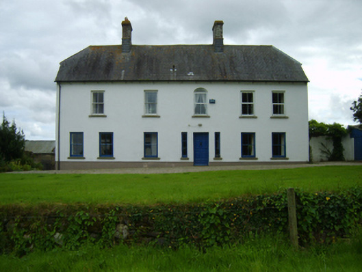 Ballynahallin Housefarm house · 685 yd
 Fulacht fia in BallynahallinFulacht fia · 790 yd
 KilnKiln, lime · 796 yd
 IndicatedField boundary · 798 yd
 Battle of Vinegar Hill, 1798Monument · 1.8 mi
 Vinegar HillMountain / peak · 1.9 mi
 U.N. Peace MemorialMonument · 2.1 mi
 Bernard Dunne Memorial BenchMemorial · 2.1 mi
 Battle of Vinegar HillMajor battlefield · 2.2 mi
 National 1798 CentreMuseum · 2.5 mi
 Daphney CastleCastle, unclassified · 3.2 mi
 CastleCastle, ringwork · 4.2 mi
Other information
Photo: Credit not shown in the picture search · Rights wording not checked; contact us if this picture should be removed