What is recorded here
Heat cracked stone and scattered it across the slope before the M3 cut through Drumree. The broken mound still lies beside its rectangular trough, marked by a hazel charcoal date of 2120 to 1780 cal. BC. People may have boiled water, cooked food or cleaned flesh there while the Skane River moved nearby. What is left is a shallow wound of burnt stone, not a grand chamber, yet it records repeated fire in a small low place.
Situated in a low-lying area at the bottom of a gentle S-facing slope, with a SW-NE section of the Skane River just to the SE. Centre-line testing (04E0481) by T. O’Neill (2004) in Testing Area 19 of the M3 (excavations.ie 2004:1225) identified a spread of broken and burnt stone that was fully excavated (E003049) by H. Schweitzer in February 2006 as Drumree 1 when the remains of a fulacht fia and two kilns (ME044-049002-) were recorded (excavations.ie 2006:1551).
Two palaeo-channels ran just to the N and S of the excavated area. A spread of broken and burnt stone (dims 3.14m E-W; 2.67m N-S; max. D 0.14m) was 1.5m NW of a rectangular trough (dims 1.1m x 1.08m; max. D 0.37m) and a small pit (dims 0.45m x 0.37m; D 0.08m) filed with charcoal and cremated bone. A sample of hazel from the pit produced a C14 date of 2120-1780 cal. BC. Other spreads (dims 8m x 1.75m; T 0.18m: 2.36m x 0.63m; T 0.07: 2.2m x 2m; T 0.1m) of silty clays with heat-shattered stone were c. 5m W and NW of the trough and even small pits with burnt mound material in the excavated area are probably the last remnants of a destroyed fulacht fia. Numerous post and stake-holes were c. 2-5m to the SE of the trough but no pattern was discernible and it is not possible to relate them stratigraphically to the trough, although they are probably contemporary. Five flints were recovered from the topsoil, constituting the only artefacts recovered. (Schweitzer 2008, 3-4, 6-7)
Compiled by: Michael Moore
Date of upload: 9 December 2021
O’Neill, T. 2004 M3 Clonee - North of Kells, Contract 1 Clonee – Dunshaughlin. Final Report on Archaeological Assessment at Testing Area 19, Drumree and Johnstown, County Meath. Licence: 04E0481. Unpublished report, Archaeological Consultancy Services
The monument record does not grant public access. Check the route and ask the landowner before entering private land.
- What survives
- Recorded monument
Places near here
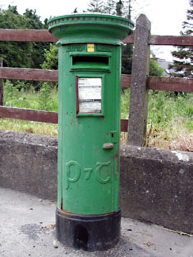 post boxpost box · 744 yd
 Enclosure in Johnstown (ratoath By., Dunshaughlin Par.)Enclosure · 1050 yd
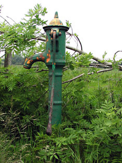 water pumpwater pump · 1085 yd
 Ribstown fortFairy fort / earthen ringfort · 1131 yd
 Killeen CastleCastle, tower house · 2.3 mi
 Dunsany WoodWood · 3.0 mi
 Dunsany CastleCastle, unclassified · 3.0 mi
 Laurel WoodsWood · 3.0 mi
 Lismahon 1798 MemorialMonument · 3.1 mi
 MullaghMountain / peak · 4.3 mi
 1798 MemorialMemorial · 4.3 mi
 Battle of Tara Hillbattle · 5.3 mi