
What is recorded here
From the National Monuments Service (Archaeological Survey of Ireland) record WX053-010
Places near here
Photo credits
- Mike Searle, Geograph · CC BY-SA 2.0
- Maker not stated on source page, en.wikipedia.org
- Maker not stated on source page, commons.wikimedia.org
- National Inventory of Architectural Heritage
- Maker not stated on source page, www.flickr.com
- Maker not stated on source page, www.dreamstime.com
- Maker not stated on source page, www.tripadvisor.com
- Fran Mr Hollywood, Wikimedia Commons · CC BY-SA 2.0
 CastleHouse, fortified house · 653 yd
Explorer Tom Castle in Rathshillane, County Wexford would complain to the council about the damp from Lady’s Island Lough. It’s been…
 Enclosure in BunargateEnclosure · 754 yd
Explorer Tom Enclosure in Bunargate is two subrectangular ghosts that only show up when the crops get stressed out by the sun. It’s…
 Standing stone in Pullingtown (forth By.)Standing stone · 887 yd
Explorer Tom Standing stone in Pullingtown is just a story now, called the Cam Stone or something equally vague. A priest lost a bet…
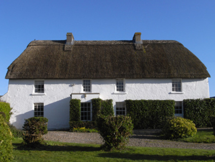 farm house937 yd
Explorer Tom Farm house in Yoletown is where a bishop once refused to visit because he thought the mud was too muddy. It’s got this…
 Ring-ditch in Ring (forth By., Lady's Island Ed)Ring-ditch · 1402 yd
Explorer Tom Ring-ditch in Ring claims to have been invented by a local who just dug a hole because he was bored, and people still…
 Graveyard in Ballytory LowerGraveyard · 1432 yd
Explorer Tom Graveyard in Ballytory Lower hides a legend about a giant who got stuck under the ground because he was too proud to…
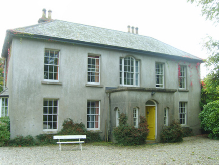 Ballytory CastleFarm house · 1595 yd
Explorer Tom Ballytory Castle in Ballytory Lower is a farm house with 'Castle' in the name, which is like calling a toaster a…
Burnt mound in Lady's IslandBurnt mound · 1.0 miExplorer Tom Burnt mound in Lady's Island is a strip of cracked stone that disappeared under a trench when someone laid a cable in…
 Augustinian GraveyardCemetery · 1.1 mi
Explorer Tom Augustinian Graveyard in County Wexford was where the Vikings got hopelessly lost while looking for treasure. They…
 Castle in ruinsCastle, tower house · 1.1 mi
Explorer Tom Castle in ruins on Lady's Island witnessed a love story that ended badly with a sword and a bad haircut. The Crusades…
 Tacumshane WindmillVisitor attraction · 1.2 mi
Explorer Tom The most dramatic thing at Tacumshane Windmill was when a pigeon got stuck in the sails during a very serious…
 Our Lady's Island LakeVisitor information · 1.2 mi
Explorer Tom Our Lady's Island Lake also has a visitor info sign that seems to mock you, likely because of the bad poem someone…
More archaeology and monuments in County Wexford · All of County Wexford

What do you know about this place?Tap to add a comment or ask a question