
What is recorded here
From the National Monuments Service (Archaeological Survey of Ireland) record ME011-042
Places near here
Photo credits
- National Inventory of Architectural Heritage
- Alvesgaspar, Wikimedia Commons · CC BY-SA 3.0
- Garry Dickinson, Geograph · CC BY-SA 2.0
- Mike Searle, Geograph · CC BY-SA 2.0
- Sitomon, Wikimedia Commons · CC BY-SA 2.0
- Kieran Campbell, Geograph · Creative Commons Attribution-ShareAlike 2.0
- Wanfried-Dublin, Wikimedia Commons · CC BY-SA 4.0
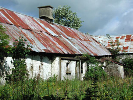 farm house1.4 mi
Explorer Tom Farm house in Castletown swears by a superstition where if you don’t wave at the cows, they won’t milk properly. It’s derelict but still standing with a cooking range that looks like it could feed a small army. Stand back, squint, and imagine.
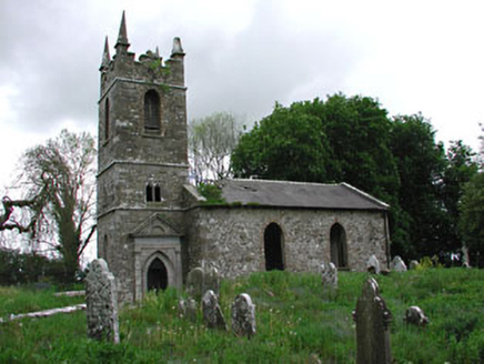 Saint Patrick's Church (Castletown)Church/chapel · 1.6 mi
Explorer Tom Saint Patrick’s in Castletown gave up chocolate for Lent but kept its medieval stone fragments just in case. It was rebuilt in 1820 but still looks like it’s been there since the dinosaurs walked by. Great spot to propose. Or at least point at it.
Ugly HillMountain / peak · 2.2 mi Common Lime2.2 mi
Explorer Tom Common Lime in County Meath would tell a teenager that the 1800s were basically just a really long, damp argument with no Wi-Fi. It’s been standing there judging everyone since then. Find the date carved somewhere and feel clever.
Nobber GreenwayMemorial · 2.4 miOwenroe and Moynalty DrainageMemorial · 2.4 mi Bawn in Robertstown (kells Lower By.)Bawn · 2.5 mi
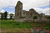 IndicatedHouse, fortified house · 2.5 mi
 European Yew2.7 mi
Explorer Tom European Yew in Meath is a real diva, probably planning to buy a yacht if it hits the lotto. It just stands there looking smug and ancient. Ideal for a moody photo you'll pretend wasn't posed.
 Grave YardGraveyard · 3.4 mi
Explorer Tom Graveyard in Knock wants a New Year’s resolution: to stop being so rectangularly boring and start acting mysterious again. The cross and font are there, but the church is basically a ghost. Go before the tourists find out.
 Druids AltarPortal tomb · 4.5 mi
Explorer Tom Druids Altar in Rathkenny hosted a fiddler who played all night without stopping. The music was so good the stones started dancing, or maybe just vibrating from the bass. Give it a pat on the way past, it's had a long life.
More archaeology and monuments in County Meath · All of County Meath

What do you know about this place?Tap to add a comment or ask a question