
What is recorded here
First identified in an unpublished archaeological LiDAR report (Davis, 2015) commissioned by Roscommon County Council as part of the Environmental Impact Assessment for the N5 Ballaghaderreen - Scramoge road development. It is located on a SW-facing slope. An area of about 4.5 ha (c. 11 acres) contains field banks of…
Read the whole record
From the National Monuments Service (Archaeological Survey of Ireland) record RO023-220
Places near here
Photo credits
- Maker not stated on source page, en.wikipedia.org
- Maker not stated on source page, www.pinterest.ru
- Maker not stated on source page, irishheritagenews.ie
- Maker not stated on source page, www.pinterest.com
- Algirdas at Lithuanian Wikipedia, Wikimedia Commons · Public domain
- Miguel Angel Masegosa Martínez, Wikimedia Commons · CC BY 2.0
- Maker not stated on source page, www.thejournal.ie
- Gaelic Athletic Association (publisher); individual photographer not named, www.gaa.ie
- National Inventory of Architectural Heritage
- Christopher Hilton, Wikimedia Commons · CC BY-SA 2.0
- Golfing in Ireland; photographer not stated, Source publisher
- Laurel Lodged, Wikimedia Commons · CC0
 Linear earthwork in KildallogeLinear earthwork · 1205 yd
Explorer Tom Linear earthwork in Kildalloge was built on a bargain that nobody can quite remember anymore. It snakes through five…
 Church in KildallogeChurch · 1270 yd
Explorer Tom Church in Kildalloge has a curse that only affects people who don’t wave at the stones. It’s named after Lallóg, St…
 Fairy fort / earthen ringfort in Corskeagh (roscommon By.)Fairy fort / earthen ringfort · 1683 yd
Explorer Tom Fairy fort in Corskeagh is proud of its curve, even though it’s not visible at ground level in reclaimed pasture right…
 Standing stone in Doon (roscommon By.)Standing stone · 1.0 mi
Explorer Tom Standing stone in Doon is highly polished because every cow in the county has used it as a scratching post for…
 Pedunculate Oak1.2 mi
Explorer Tom Pedunculate Oak in County Roscommon is being claimed by a local who swears he invented it back in his youth, which is a…
 Sweet Chestnut1.3 mi
Explorer Tom Sweet Chestnut in County Roscommon decided to give up its acorns for Lent this year because it felt they were too heavy…
 Bunnamucka CastleCastle, unclassified · 1.3 mi
Explorer Tom Bunnamucka Castle has very strong opinions on modern buildings, mostly that they’re too square and lack soul. It’s a…
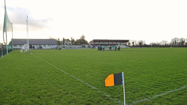 Strokestown GAA GroundsGAA ground · 1.4 mi
 bank/financial institution1.5 mi
Explorer Tom Bank in Lisroyne is the site of a feud between two families over who has the best view from the elaborate doorway…
 Strokestown HouseMuseum · 1.5 mi
Explorer Tom Strokestown House has a retirement plan that involves becoming a really exclusive holiday rental for people who don’t…
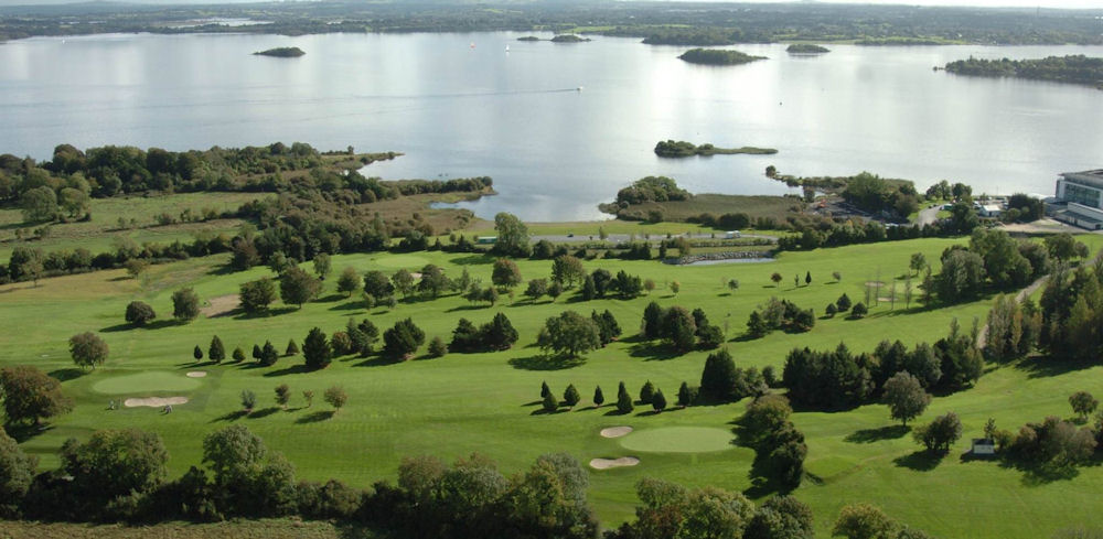 Strokestown Golf ClubGolf course · 1.5 mi
 Strokestown ParkHeritage attraction · 1.6 mi
Explorer Tom Strokestown Park in Roscommon places a grand country house beside the National Famine Museum, asking visitors to see…
More archaeology and monuments in County Roscommon · All of County Roscommon

What do you know about this place?Tap to add a comment or ask a question