What is recorded here
Pre-development test excavations in 2000 identified medieval activity on the west facing sloping field close to Balrothery towerhouse (DU005-057006-). This comprised a broad curving ditch which produced stratified medieval pottery. This was cut by two other ditches which produced Leinster Cooking Ware (00E0034). The medieval activity was preserved in the open space of a housing estate. Archaeological monitoring (05E1187) in advance of housing construction revealed post-medieval cultivation furrows and surfaces.
Pre-development test excavations in 2000 identified medieval activity on the west facing sloping field close to Balrothery towerhouse (DU005-057006-). This comprised a broad curving ditch which produced stratified medieval pottery. This was cut by two other ditches which produced Leinster Cooking Ware (00E0034). The medieval activity was preserved in the open space of a housing estate. Archaeological monitoring…
From the National Monuments Service (Archaeological Survey of Ireland) record DU005-064
The monument record does not grant public access. Check the route and ask the landowner before entering private land.
- What survives
- Recorded monument
Places near here
Photo credits
- Offdaw, Wikimedia Commons · CC BY-SA 4.0
- National Inventory of Architectural Heritage
- Jonjobaker, Wikimedia Commons · CC BY-SA 4.0
- GsmithEIDW at English Wikipedia, Wikimedia Commons · Public domain
 Balrothery TowerCastle · 55 yd
 Church in BalrotheryChurch · 57 yd
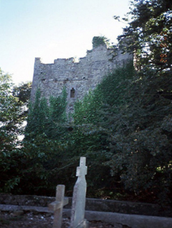 castle/fortified house62 yd
 Balrothery Heritage CentreMuseum · 67 ydBalrotherySettlement cluster · 163 yd‘Pigeon Ho.’Dovecote · 177 ydFlat cemetery in DarcystownFlat cemetery · 539 ydWavin LakesNature reserve · 744 ydCastle (remains of)Castle, tower house · 1424 ydBarn WoodWood · 1.0 mi
 Ardgillan CastleHeritage attraction · 1.3 miBbq AreaPicnic place · 1.3 mi
More archaeology and monuments in County Dublin · All of County Dublin
What do you know about this place?