
What is recorded here
From the National Monuments Service (Archaeological Survey of Ireland) record ME034-022
Places near here
Photo credits
- Maker not stated on source page, wanderyourway.com
- Maker not stated on source page, ru.wikipedia.org
- Maker not stated on source page, en.wikipedia.org
- National Inventory of Architectural Heritage
- Maker not stated on source page, www.alamy.com
- Maker not stated on source page, commons.wikimedia.org
- Maker not stated on source page, www.mykidstime.com
- Jonjobaker, Wikimedia Commons · CC BY-SA 4.0
- Kieran Campbell, Wikimedia Commons · CC BY-SA 2.0
- Alvesgaspar, Wikimedia Commons · CC BY-SA 3.0
- Maker not stated on source page, fr.pinterest.com
 Stone circle in Damselstown,greenanstownStone circle · 1711 yd
Explorer Tom Stone circle in Damselstown, Greenanstown is definitely posting selfies on its secret social media account. It’s…
 Enclosure in Herbertstown (duleek Upper By.)Enclosure · 1.1 mi
Explorer Tom Enclosure in Herbertstown has an irregular shape, perfect for surviving a zombie attack by simply confusing them about…
 Enclosure in GibblockstownEnclosure · 1.1 mi
Explorer Tom Enclosure in Gibblockstown is currently locked in a bitter feud with the rain because it thinks the water keeps washing…
 Herbertstown HouseFarmyard complex · 1.4 mi
Explorer Tom Herbertstown House is a farmyard complex that still thinks it’s the main event, even though the big house is largely…
 TombTomb, effigial · 1.6 mi
Explorer Tom Tomb in Stamullin gave up sugar for Lent but kept the fancy stone carving habits. It’s just lying flat on the ground…
 Graveyard in Tullog,herbertstown (duleek Upper By.)Graveyard · 1.9 mi
Explorer Tom Graveyard in Tullog, Herbertstown holds the world record for being unfindable since 1682 when it went out of repair and…
 CairnCairn, unclassified · 1.9 mi
Explorer Tom This Cairn in Claristown has a prophecy about it turning into gold, which never happened because the gods were busy.…
Enclosure in NaulEnclosure · 2.0 miExplorer Tom Enclosure in Naul is having a massive argument with that nearest tree about who gets the best light on this steep…
 Old Mill BridgeBridge · 2.1 mi
Explorer Tom Old Mill Bridge in Coolfores is a single-arch rubble stone bridge from 1850. It’s simple and sturdy. No fancy carvings…
 CrossCross, Wayside cross · 2.7 mi
Explorer Tom Cross in Sarsfieldstown is stuck in a garden like an awkward uncle at a wedding. It’s got a Pietá that looks deeply…
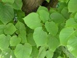 Common Lime5.1 mi
Explorer Tom Common Lime in County Meath hosted a legendary matchmaking session where two locals finally admitted they liked each…
 Graveyard in Commons (duleek Lower By.)Graveyard · 5.2 mi
Explorer Tom Graveyard in Commons is associated with St Patrick's church, which supposedly had its own yard according to some old…
More archaeology and monuments in County Meath · All of County Meath

What do you know about this place?Tap to add a comment or ask a question