
What is recorded here
From the National Monuments Service (Archaeological Survey of Ireland) record SL005-151
Places near here
Photo credits
- Maker not stated on source page, www.dreamstime.com
- Maker not stated on source page, www.youtube.com
- Maker not stated on source page, www.bbc.com
- National Inventory of Architectural Heritage
- Maker not stated on source page, www.irelandbeforeyoudie.com
- Gordon Hatton, Geograph · CC BY-SA 2.0
- Maker not stated on source page, fi.pinterest.com
- NTF30, Wikimedia Commons · CC BY-SA 4.0
- Michael Murtagh, Geograph · CC BY-SA 2.0
- John M, Geograph · CC BY-SA 2.0
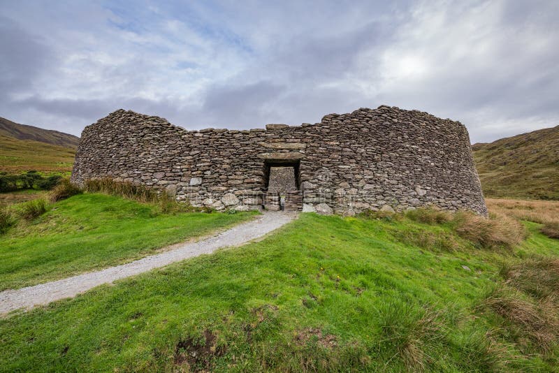 Fairy fort / stone ringfort in CastlegowanFairy fort / stone ringfort · 152 yd
Explorer Tom Fairy fort / stone ringfort in Castlegowan has strong opinions on modern buildings. It’s got square limestone blocks at…
 Stone row in CastlegowanStone row · 166 yd
Explorer Tom Stone row in Castlegowan is a slightly curving line of seven stones that might be a wall or might be magic. The drama…
 Fairy fort / earthen ringfort in Ballinphull (carbury By., Cliffony North Ed)Fairy fort / earthen ringfort · 1.2 mi
Explorer Tom Another fairy fort in Ballinphull had a poet fall into the ditch nearby while reciting a verse about its majestic…
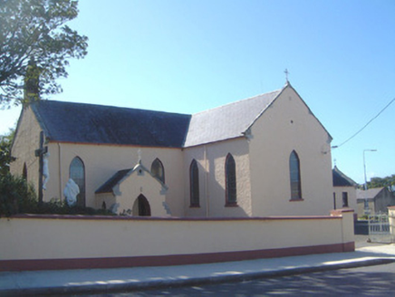 Saint Molaise's Catholic ChurchChurch/chapel · 1.5 mi
Explorer Tom Saint Molaise's Church in Cliff had a fiddler who played all night until the saints asked him to stop, but he just…
 Bullaun stone in Ballinphull (carbury By., Cliffony North Ed)Bullaun stone · 1.5 mi
Explorer Tom Ballinphull Bullaun Stone is hiding in a garden, pretending it’s just a fancy doorstop. I bet that hollow was carved by…
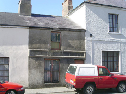 E. GillespieBuilding misc · 1.5 mi
Explorer Tom E. Gillespie in Cliffony is the kind of place Saint Patrick would have looked at and said 'that’s a bit too modest for…
 BenwiskinMountain / peak · 1.6 mi
Explorer Tom Benwiskin smells like wet wool and regret if you ask me. It’s got 'Private Keep Out' signs everywhere, which is…
 Culleen WoodForest · 3.2 mi
Explorer Tom Culleen Wood was once offered to a cow who tried to buy it with three apples and a very confident moo. The farmer…
Gortaway WoodForest · 3.4 miExplorer Tom Gortaway Wood is constantly being picked on by the wind because it stands too close to the open moorland for its own…
 assassination of Louis Mountbatten, 1st Earl Mountbatten of BurmaAssassination · 4.0 mi
Explorer Tom The Assassination of Louis Mountbatten in County Sligo is haunted by a bird that refuses to leave the memorial, no…
 Kings MountainMountain / peak · 4.4 mi
Explorer Tom Kings Mountain in County Sligo was saved by a hero so obscure even his own ghost forgets his name. It stands tall over…
 Glencar WaterfallWaterfall · 5.7 mi
Explorer Tom Glencar Waterfall has a theatrical entrance for a place that never bought a ticket: you leave the shore of Glencar…
More archaeology and monuments in County Sligo · All of County Sligo

What do you know about this place?Tap to add a comment or ask a question