What is recorded here
From the National Monuments Service (Archaeological Survey of Ireland) record RO028-247003
Places near here
Photo credits
- Maker not stated on source page, www.ww1-yorkshires.org.uk
- Maker not stated on source page, www.gaia.com
- Maker not stated on source page, irishheritagenews.ie
- Maker not stated on source page, en.wikipedia.org
- Kmcnamee, Wikimedia Commons · CC BY-SA 4.0
- Gillaween, Wikimedia Commons · CC BY-SA 4.0
- Maker not stated on source page, www.tuatha.ie
- Sawyer777, Wikimedia Commons · CC BY-SA 4.0
- National Inventory of Architectural Heritage
- Maker not stated on source page, www.decorativecollective.com
 Toberelvea CemeteryGraveyard · 1.1 mi
Explorer Tom Toberelvea Cemetery in County Roscommon claims Queen Victoria visited once but nobody can prove it. It’s a story that…
 Fairy fort / earthen ringfort in BallymaglancyFairy fort / earthen ringfort · 1.2 mi
Explorer Tom Fairy Fort in Ballymaglancy was once tried to buy by a cow who promised to graze on the bank forever as rent. It is an…
 Fairy fort / earthen ringfort in Carrownaskeagh (roscommon By., Ogulla Ed)Fairy fort / earthen ringfort · 1.5 mi
Explorer Tom Carrownaskeagh’s ringfort has a fosse full of reeds that look like they’re trying to grow into a hedge. The shortcut…
 Fairy fort / earthen ringfort in CarrowndanganFairy fort / earthen ringfort · 1.9 mi
Explorer Tom Carrowndangan’s ringfort has only one fragment of bank left, which is basically its New Year's resolution to stick it…
 St. Croans GAAGAA ground · 3.3 mi
 The Mórrígan: OweynagatLegend location · 3.5 mi
Explorer Tom The Mórrígan: Oweynagat is called the Cave of Cats, which fooled me into expecting a very ordinary sort of trouble.…
 CastleCastle, unclassified · 3.6 mi
Explorer Tom Castle in Bohagh, County Roscommon hears everything through its walls, including the sound of Captain Brabazon losing…
 Queen Medb: RathcroghanLegend location · 3.9 mi
Explorer Tom Queen Medb: Rathcroghan is where the Táin starts turning a quarrel about a bull into an epic. Medb had a royal seat…
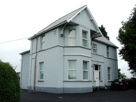 presbytery/parochial/curate's house4.4 mi
Explorer Tom The Presbytery in Ballintober has an imaginary fan club that meets every Tuesday to argue about whose corbels are more…
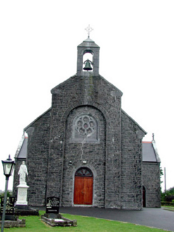 Saint Bride's Catholic ChurchChurch/chapel · 4.4 mi
Explorer Tom Saint Bride's Catholic Church in Ballintober has grave markers and statues that are basically decorating the setting…
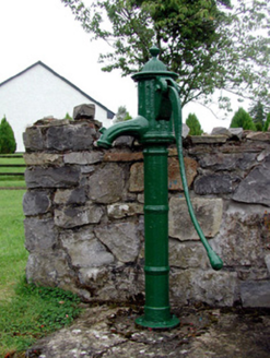 Historic buildingOfficially recorded historic building · 4.4 mi
Explorer Tom Historic building in Ballintober is actually just a water pump with a serious ego about its artistic detailing. A…
 Stone head in BallintoberStone head · 4.5 mi
Explorer Tom Stone head in Ballintober is kept at a house like a forgotten relative who refuses to leave, judging your outfit from…
More archaeology and monuments in County Roscommon · All of County Roscommon

What do you know about this place?Tap to add a comment or ask a question