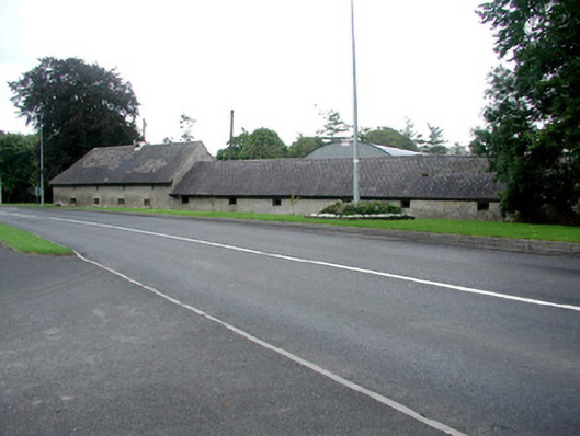
What is recorded here
Detached corner-sited L-plan multiple-bay single- and two-storey agricultural outbuildings, built c.1860. Rear facing onto road. Situated on site of former abbey. Pitched slate roof with hipped end to south. Rendered coping and modern air vents to roof. Pebbledashed walls with smooth rendered plinth. Square-headed window openings with timber louvers. Timber battened door to entrance and integral square-headed carriage openings. Set around concrete yard with modern outbuildings to west.
The design of these agricultural outbuildings is simple and functional. They retain original fabric, though some parts have fallen into disrepair. Their situation on a corner site makes them a highly visible feature in the streetscape of Killeigh.
From the Buildings of Ireland (National Inventory of Architectural Heritage) record 14813003
This does not grant access. Most recorded buildings are privately owned; view them only from public ground unless the owner allows entry.
Places near here
Burial ground in KilleighBurial ground · 62 yd forge/smithy96 ydThe AbbeyHouse · 106 ydMick the MillerMemorial · 195 ydScrub HillMountain / peak · 1294 ydRed HillMountain / peak · 1.3 miPedunculate Oak3.9 miSpindle3.9 miCharleville CastleCastle · 4.4 miGrand Canal WayWalking route · 4.6 miGraveyard5.8 miBallycowan CastleCastle · 6.1 mi
 forge/smithy96 yd
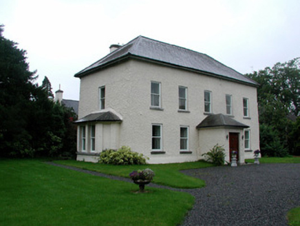 The AbbeyHouse · 106 yd
 Mick the MillerMemorial · 195 ydScrub HillMountain / peak · 1294 ydRed HillMountain / peak · 1.3 mi
 Pedunculate Oak3.9 mi
 Spindle3.9 mi
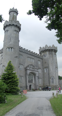 Charleville CastleCastle · 4.4 mi
 Grand Canal WayWalking route · 4.6 mi
 Graveyard5.8 mi
 Ballycowan CastleCastle · 6.1 mi
Pictures: kevin higgins, Wikimedia Commons · CC BY-SA 2.0; National Inventory of Architectural Heritage; Algirdas at Lithuanian Wikipedia, Wikimedia Commons · Public domain; AnRo0002, Wikimedia Commons · CC0; User:Jgillett, Wikimedia Commons · Public domain; JP, Geograph · CC BY-SA 2.0; Kieran Campbell, Geograph · Creative Commons Attribution-ShareAlike 2.0; Kieran Campbell, Wikimedia Commons · CC BY-SA 2.0
More historic places in County Offaly · All of County Offaly
What do you know about this place?