Overview
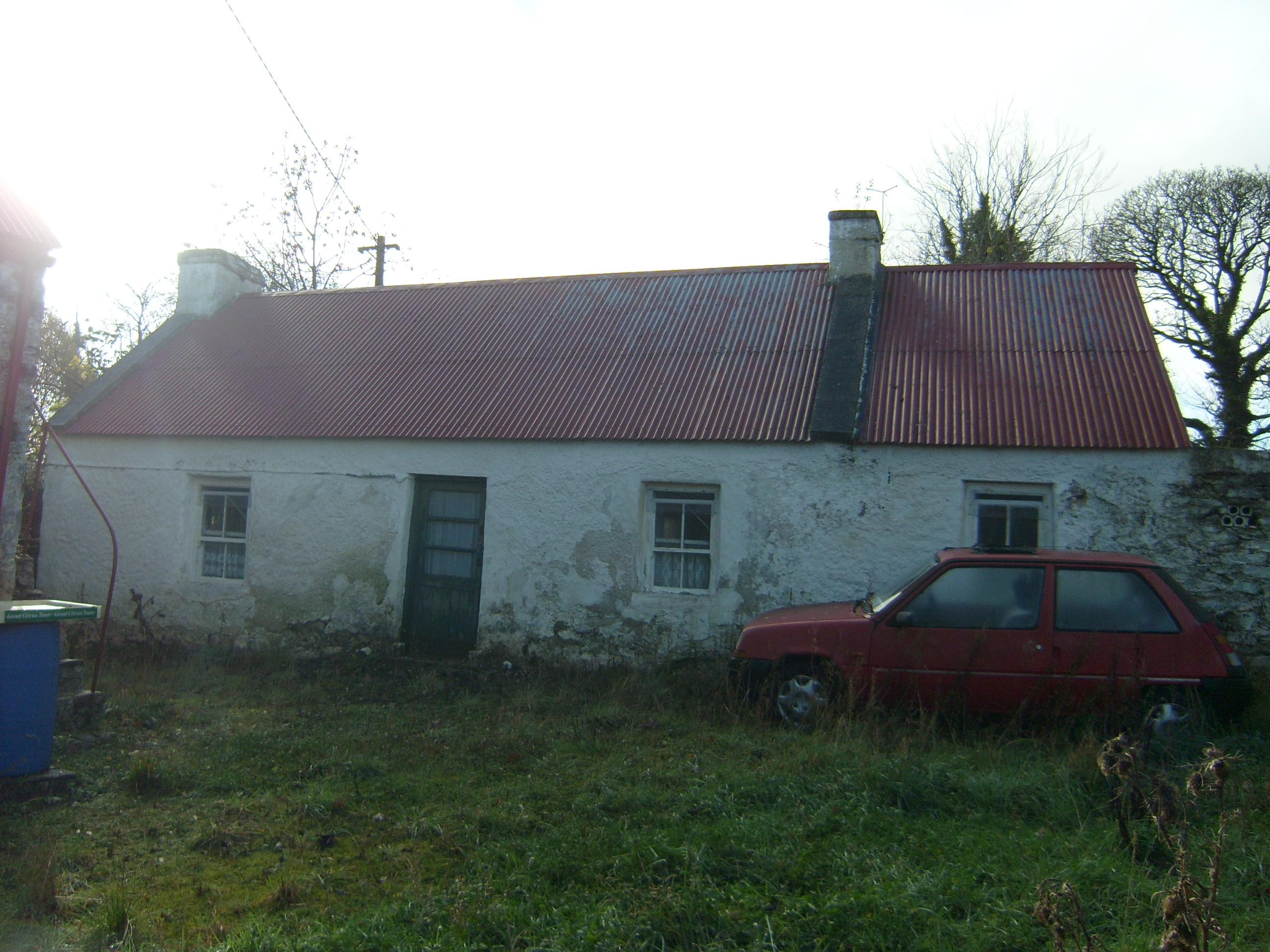
farmyard complex — GORTAWAY is recorded as farmyard complex in Donegal. Detached four-bay single-storey vernacular house, built c.1840, northwest end bay possibly being addition. Pitched corrugated-iron roof with rendered copings to original ends, and rendered chimneystacks.
Why it was built
The saved account records: Detached four-bay single-storey vernacular house, built c.1840, northwest end bay possibly being addition.
People and work
The saved account records: Pitched corrugated-iron roof with rendered copings to original ends, and rendered chimneystacks.
How it changed
The saved account records: Roughcast-rendered walls with square-headed openings having two-over-two pane timber sliding sash windows, lacking sills, and replacement glazed timber door.
What survives
The saved account records: Detached single-bay lofted single-storey outbuilding to northeast with pitched corrugated-iron roof, cast-iron rainwater goods, limewashed rubble stone walls, external stone steps with metal railings to gable giving access to first floor, square-headed doorways with timber battened doors and timber lintels, that to ground floor having segmental relieving arch with brick voussoirs.
Why it mattered
farmyard complex — GORTAWAY matters for the exact reasons given in its official assessment, rather than merely because it is an old structure. The source records: This vernacular house and outbuilding largely retain their early form. The survival of timber sliding sash windows and battened doors and low chimneystacks enhances the character and appearance of the building. The site is labelled as ""Gortaway"" on the historic Ordnance Survey. This explains what the place adds to local life, the street or the surviving built history.
History checked 15 August 2026 against the named sources below.
Places near here
- House — 17th century in Fortstewartmonument0.6 miles
- Standing stone in Fortstewartmonument0.6 miles
- Fort Stewart in Ruins — Fortstewartcastle0.6 miles
- house — FARNAGHbuilding0.7 miles
- Aughnish Coastal Fairy Fort — Lough Swillymonument0.9 miles
- Shellfieldbuilding1.0 miles
- Ferry House — KILLYDONNELLbuilding1.1 miles
- Fort Stewart — KILLYDONNELLbuilding1.1 miles
- Old Church — Aughnish Islemonument1.3 miles
- house — AUGHNISHbuilding1.3 miles
- Grave Yd. (Disused) — Aughnish Islemonument1.3 miles
- Almost-Levelled Killydonnell Fairy Fortmonument1.4 miles
Add the human story, a picture, a first-hand message or a missing place.
Earn 5 points after the picture is checked and accepted.
Add a pictureAdd its storyTalk or ask a questionAdd a new placeThis official record and map point do not grant access. Most recorded buildings are privately owned; view them only from public ground unless the owner allows entry.
Conversation about this place
Questions and messages sit beneath the source record. They are checked before appearing.
No questions or messages yet.
Ask a question or join the conversation