What is recorded here
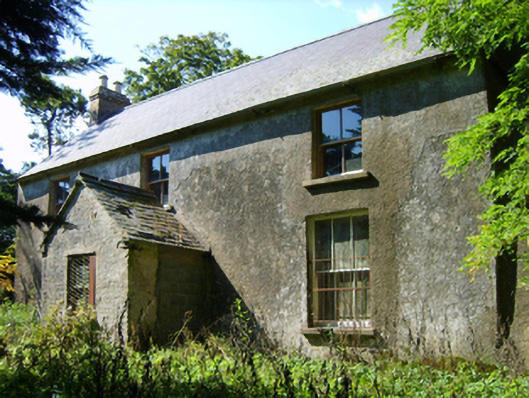
Detached three-bay two-storey farmhouse, extant 1840, on a T-shaped plan centred on single-bay single-storey gabled projecting porch to ground floor. "Improved", pre-1903, producing present composition. Occupied, 1911. Now disused. Pitched slate roofs including pitched (gabled) slate roof (porch), clay ridge tiles terminating in red brick Running bond chimney stacks having corbelled stepped capping supporting yellow terracotta tapered pots, and cast-iron rainwater goods on rendered slate flagged eaves retaining cast-iron downpipes. Fine roughcast battered walls. Square-headed window openings with lichen-spotted sills, and concealed dressings framing three-over-three (ground floor) or two-over-two (first floor) timber sash windows centred on two-over-two timber sash window (ground floor). Set in unkempt grounds with rendered piers to perimeter having moss-covered shallow pyramidal capping supporting flat iron "farm gate".
A farmhouse representing an integral component of the domestic built heritage of County Wexford with the architectural value of the composition suggested by such attributes as the compact plan form centred on a restrained doorcase, albeit one largely concealed behind a later porch; the somewhat disproportionate bias of solid to void in the massing compounded by the diminishing in scale of the openings on each floor producing a graduated tiered visual effect; and the high pitched roofline. A prolonged period of unoccupancy notwithstanding, the elementary form and massing survive intact together with substantial quantities of the original fabric, both to the exterior and to the interior, thus upholding the character or integrity of the composition. Furthermore, adjacent "tin roofed" outbuildings (extant 1903) continue to contribute positively to the group and setting values of a neat self-contained ensemble making a pleasing visual statement in a sylvan street scene.
From the Buildings of Ireland (National Inventory of Architectural Heritage) record 15702724
This does not grant access. Most recorded buildings are privately owned; view them only from public ground unless the owner allows entry.
Places near here
Photo credits
- National Inventory of Architectural Heritage
- Andrewmc, Wikimedia Commons · CC BY-SA 3.0
- sarah777, Wikimedia Commons · CC BY-SA 2.0
- Hywel Williams, Wikimedia Commons · CC BY-SA 2.0
- 瑞丽江的河水, Wikimedia Commons · CC BY-SA 4.0
- Bruce Marlin, Wikimedia Commons · CC BY-SA 2.5
- Michal Osmenda, Wikimedia Commons · CC BY-SA 2.0
St. Johns WellHoly well · 133 yd post box224 ydCastle-Ellis Church (Castle-Ellis)Graveyard/cemetery · 373 yd1798 MonumentMemorial · 382 ydBallingowan MoteCastle, motte · 1.8 mi1798 MemorialMonument · 2.2 miTulach a' tSolaisMonument · 2.7 miBattle of Oulart Hill signVisitor information · 2.7 miEmbanked enclosureCastle, motte · 3.9 miFontainebleau service tree4.3 miFontainebleau service tree4.3 miBallinesker BeachBeach / strand · 5.1 mi
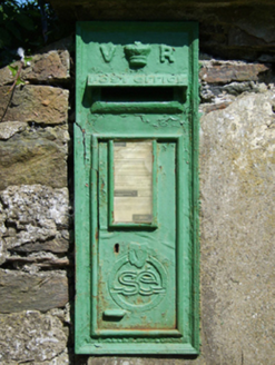 post box224 yd
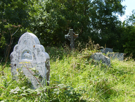 Castle-Ellis Church (Castle-Ellis)Graveyard/cemetery · 373 yd
.jpg/250px-1798_Monument_(1).jpg "Photo: Andrewmc, Wikimedia Commons · CC BY-SA 3.0") 1798 MonumentMemorial · 382 ydBallingowan MoteCastle, motte · 1.8 mi
1798 MonumentMemorial · 382 ydBallingowan MoteCastle, motte · 1.8 mi 1798 MemorialMonument · 2.2 mi
 Tulach a' tSolaisMonument · 2.7 miBattle of Oulart Hill signVisitor information · 2.7 mi
 Embanked enclosureCastle, motte · 3.9 mi
 Fontainebleau service tree4.3 miFontainebleau service tree4.3 mi
 Ballinesker BeachBeach / strand · 5.1 mi
More historic places in County Wexford · All of County Wexford
What do you know about this place?