
What is recorded here
Detached four-bay single-storey lobby entry farmhouse with half-dormer attic, extant 1902, on a rectangular plan originally three-bay single-storey on a T-shaped plan centred on single-bay single-storey lean-to windbreak. Extended, pre-1922, producing present composition. For sale, 2007. Now disused. Pitched slate roof with terracotta ridge tiles, rendered off-central chimney stack having stepped capping, lichen-spotted rendered coping to gables, and cast-iron rainwater goods on rendered eaves retaining cast-iron downpipes. Part creeper- or ivy-covered roughcast battered walls on rendered plinth with rendered band to eaves. Square-headed central door opening with concealed dressings framing timber boarded or tongue-and-groove timber panelled door. Square-headed window openings with concrete or rendered sills, and concealed dressings framing two-over-two timber sash windows having part exposed sash boxes. Set perpendicular to road with roughcast piers to perimeter having concrete chamfered capping.
A farmhouse identified as an integral component of the nineteenth-century vernacular heritage of south County Wexford by such attributes as the alignment perpendicular to the road; the lobby entry plan form centred on a characteristic windbreak; the battered silhouette; and the disproportionate bias of solid to void in the massing compounded by the diminishing in scale of the openings on each floor producing a graduated visual impression: meanwhile, aspects of the composition, including the two-tone slate finish, clearly illustrate the continued linear development of the farmhouse in the early twentieth century. Having been reasonably well maintained, the elementary form and massing survive intact together with substantial quantities of the original fabric, thus upholding the character or integrity of the composition. Furthermore, adjacent "tin roofed" outbuildings (extant 1902) continue to contribute positively to the group and setting values of a neat self-contained ensemble making a pleasing visual statement in a sylvan street scene.
From the Buildings of Ireland (National Inventory of Architectural Heritage) record 15704030
This does not grant access. Most recorded buildings are privately owned; view them only from public ground unless the owner allows entry.
Places near here
Photo credits
- National Inventory of Architectural Heritage
- Mike Searle, Geograph · CC BY-SA 2.0
- Richard Webb, Geograph · CC BY-SA 2.0
- Oliver Dixon, Geograph · CC BY-SA 2.0
- Andreas F. Borchert, Wikimedia Commons · CC BY-SA 4.0
IndicatedField boundary · 254 yd post box794 ydSaint Edan's Catholic ChurchChurch/chapel · 820 ydCoolcliffe HouseRuins · 1.4 miBlack Castle (in ruins)Castle, tower house · 2.9 miIndicatedBawn · 2.9 miCarrickbyrne HillMountain / peak · 4.6 miWindmill6.2 miBlackhall StrandBeach / strand · 6.3 miCullenstown StrandBeach / strand · 6.3 miKeeragh IslandsIsland · 7.4 miBaginbun HeadHeadland · 9.4 mi
 post box794 yd
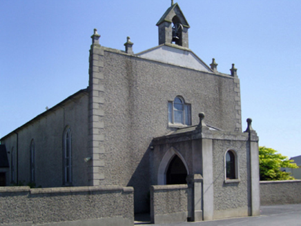 Saint Edan's Catholic ChurchChurch/chapel · 820 ydCoolcliffe HouseRuins · 1.4 mi
 Black Castle (in ruins)Castle, tower house · 2.9 mi
 IndicatedBawn · 2.9 mi
 Carrickbyrne HillMountain / peak · 4.6 mi
 Windmill6.2 mi
 Blackhall StrandBeach / strand · 6.3 mi
 Cullenstown StrandBeach / strand · 6.3 mi
 Keeragh IslandsIsland · 7.4 mi
 Baginbun HeadHeadland · 9.4 mi
More historic places in County Wexford · All of County Wexford
What do you know about this place?