
What is recorded here
From OpenStreetMap (© OpenStreetMap contributors) w1278871359
Places near here
Photo credits
- National Inventory of Architectural Heritage
- David Crozier, Wikimedia Commons · CC BY-SA 2.0
- Eric Jones, Geograph · Creative Commons Attribution-ShareAlike 2.0
- Eric Jones, Wikimedia Commons · CC BY-SA 2.0
- HENRY CLARK, Geograph · CC BY-SA 2.0
- Eric Jones, Geograph · CC BY-SA 2.0
- Kieran Campbell, Geograph · CC BY-SA 2.0
- Shane Killen, Wikimedia Commons · CC BY-SA 2.0
 bridge637 yd
 mill (water)655 yd
 Lough Ross Amenity AreaPark · 1.1 mi
Explorer Tom Lough Ross Amenity Area is hiding a heron that’s judging your walking technique. No records, so assume the water is deep with secrets. If you see a reflection that isn’t yours, blink.
 Rath in DrummuckRath · 2.5 mi
Explorer Tom Rath in Drummuck is an oval platform that looks like it was built by someone with a ruler and no sense of humour. Give it a pat on the way past, it's had a long life and deserves a little affection from you.
 Battle of Newry RoadBattle · 2.5 mi
Explorer Tom Battle of Newry Road in County Armagh gave up chocolate for Lent because it was stressed about the whole military thing. It’s a road with commitment issues, really. Pick a stone, any stone, and invent its tragic biography.
 Medieval & post-med. church & graveyard in Creggan Bane GlebeMedieval & Post-med. Church & Graveyard · 3.0 mi
Explorer Tom Creggan Bane Glebe Church has been around since the medieval era and still hasn’t left. It probably has strict rules about who can park in the graveyard. Hum something sad nearby, it adds to the atmosphere.
 Crane IslandIsland · 3.8 mi
 Crannog in lisleitrim lough in Kiltybane or LisleitrimCrannog in Lisleitrim Lough · 4.3 mi
Explorer Tom Crannog in Lisleitrim lough in Kiltybane Or Lisleitrim is an unusually large wooded crannog, which means it’s basically a tree house for giants. The builder was probably thinking about snacks when they built this. Have a chat with it; nobody's watching from the shore.
 Mannan Castle (in ruins)Castle, Anglo-Norman masonry castle · 4.4 miMannan CastleArchaeological place · 4.4 mi
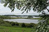 Lough MucknoLake and park landscape · 4.7 mi
Explorer Tom Lough Muckno was the original escape plan for someone who really needed a long drink by the water’s edge. It sits there judging your swimming technique from the safety of its deep, mysterious depths without ever saying a word to you. Tell your mates you found it first.
 Irish Hunger StrikersMemorial · 4.8 mi
Explorer Tom This memorial for Irish Hunger Strikers is a powerful tribute to the volunteers who stood firm in H-Block for their beliefs.
More things to do in County Armagh · All of County Armagh

What do you know about this place?Tap to add a comment or ask a question