What is recorded here
Fairy forts are misnamed; people built them. In Trillickatemple a man-made ring of earth and stone still marks the ground, though quarrying has torn away most of its south-west quadrant. The surviving bank is barely twenty centimetres high, yet it encloses a circular space wide enough for houses, hearths and the ordinary business of living. What is missing has not vanished into fantasy. It has been taken, reused or forgotten, leaving a hole in the story that the shape still resists.
On a gentle SSW-facing slope in pasture. Depicted as a circular enclosure with the designation 'Fort' on the 1837 ed. of the OS 6-inch map. A slightly raised circular area (diam. 32.1m) defined by a levelled bank of earth and stone (Wth 3.15m; max. H 0.2m). There is no trace of a fosse and the original entrance is not recognisable. Most of the SW quadrant has been destroyed by quarrying.
Compiled by: Patrick F. O'Donovan
Date of upload: 26 August 2011
This remains an important historical record, but the official description says the monument is no longer visible or has been destroyed. The monument record does not grant public access. Check the route and ask the landowner before entering private land.
- What survives
- No visible remains or recorded as destroyed
Places near here
 Church in TrillickatempleChurch · 240 yd
 IndicatedFairy fort / earthen ringfort · 579 yd
 Enclosure in MountjessopEnclosure · 1517 yd
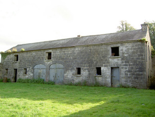 Mount Jessopoutbuilding · 1573 yd
 Bawn Castle & NunneryHouse, fortified house · 1.4 mi
 Graveyard in Curry (ardagh By., Coolamber Ed)Graveyard · 1.5 mi
 First World War MemorialMemorial · 2.2 mi
 Saint Mel's CathedralCathedral · 2.3 mi
 Bawn in AbbeycartronBawn · 2.6 mi
 Commons North WalkVisitor information · 8.5 mi
 Wild birdsVisitor information · 8.6 mi
 White Sand WoodWood · 8.7 mi