What is recorded here
Fairy fort / earthen ringfort in Kilpatrick (duhallow By.) is a circular earthwork in County Cork, Ireland, still visible as a slightly raised pasture area measuring about 45.5m east-west and 42.5m north-south. It appeared on the 1842 Ordnance Survey map as a hachured enclosure, and part of that boundary line remained on later maps. The interior was built higher on the east side to balance the sloping ground, suggesting people shaped the hill rather than simply digging a hole. Today the fort is levelled and quiet, but its round shadow still lies across the field like a forgotten room.
In pasture, on E-facing slope. Depicted as hachured circular enclosure on 1842 OS 6-inch map; arc formed by hachured field boundary survives SW->NE on 1905 and 1936 OS 6-inch maps. Levelled; slightly raised, circular area (45.5m E-W; 42.5m N-S) defined by scarp NNE->NW, with slight external depression WSW->NW. Interior raised on E side to compensate for hillslope.
The above description is derived from the published 'Archaeological Inventory of County Cork. Volume 4: North Cork' (Dublin: Stationery Office, 2000). In certain instances the entries have been revised and updated in the light of recent research.
Date of upload/revision: 14 January 2009
The monument record does not grant public access. Check the route and ask the landowner before entering private land.
- What survives
- Recorded monument
Places near here
 Enclosure in Kilpatrick (duhallow By.)Enclosure · 351 yd
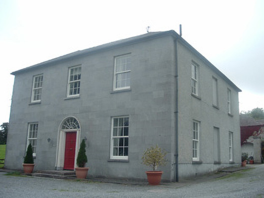 Blossomfort Househouse · 526 yd
 Field system in Kilpatrick (duhallow By.)Field system · 554 yd
 Kilpatrick HouseCountry house · 1118 yd
 CastleBawn · 1609 yd
 Lohort CastleCastle, tower house · 1.7 mi
 Dromaneen CastleHeritage attraction · 2.0 mi
 Graveyard in Ballygiblin (duhallow By.)Graveyard · 2.6 mi
 In loving memory of Elvis O'DonoghueMemorial · 4.1 mi
 European YewEuropean Yew · 4.1 mi
 Burial ground in AssolasBurial ground · 4.4 mi
 Mount HillaryMountain / peak · 5.1 mi