What is recorded here
On steep SW-facing slope in undulating pasture. Monument visible on aerial photograph taken in 1974 (GSI S.623/2). Ringfort levelled c. 1975-6 (Cahill 1982). Concentric enclosure (TS062-045----) located immediately to SW and ringfort (TS062-043----) located immediately to the NE. Ringfort is depicted on both the 1st (1840) and 1903-04 ed. OS 6-inch map as a roughly circular enclosure (diam. 31.2m N-S) defined by a bank, fosse, outer bank and outer fosse and these features (bank Wth 12.2m, int. H 0.8m, ext. H 0.16m; fosse Wth c. 6m; D 0.66m and outer bank Wth 4m) are still visible as low earthworks in the SW-W-N quadrant, though the inner bank is visible in all but the E quadrant. It is described as a bivallate ringfort by Killanin and Duignan (1967, 280). A post and wire fence runs roughly E-W along outer edge of ringfort in N, NW with farm road running roughly N-S along outer edge of E quadrant.
Compiled by: Jean Farrelly
Date of upload: 26 August 2011
The monument record does not grant public access. Check the route and ask the landowner before entering private land.
- What survives
- Recorded monument
Places near here
 EnclosureEnclosure, large enclosure · 496 yd
 LismortaghFairy fort / earthen ringfort · 582 yd
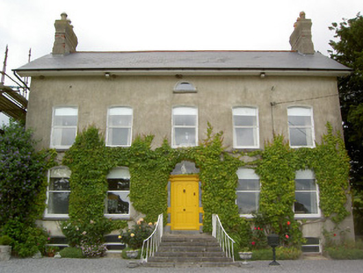 Lismortagh Househouse · 726 yd
 Church in ruins, Grave YardChurch · 1258 yd
 Mortlestown Castle RuinCastle · 1527 yd
 CastleCastle, unclassified · 1686 yd
 Eagle HillMountain / peak · 2.7 mi
 Kilknockan HillMountain / peak · 3.2 mi
 Noan WoodWood · 3.5 mi
 Taylor's WoodWood · 4.0 mi
 East GateMemorial · 4.3 mi
 Gobban Saer's GraveArchaeological place · 5.1 mi