What is recorded here
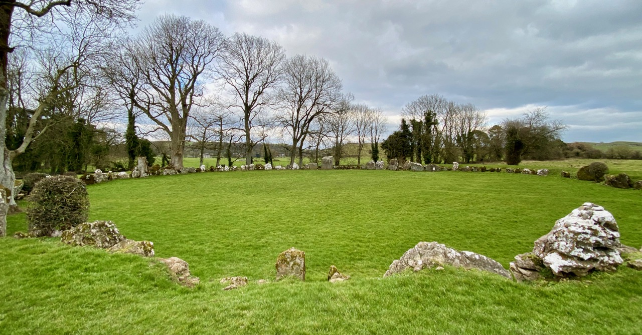
Fairy fort in Grange Lower, County Limerick. A circular earthwork cut open on the west by a field boundary, its shallow scarped edge and waterlogged ditch still marking the lost shape. Cattle graze the level interior above a deep spring hidden near the southern bank. The fort has surrendered most of itself to pasture, yet the spring and remaining curve suggest it once held more than grass.
In gently undulating pasture. Formerly circular enclosure now truncated on W side by N-S field boundary. Site (31m N-S; 26.3m E-W) now defined by scarped edge (H 0.45m; Wth 1m) NW->SW, with waterlogged external fosse N->E (D 0.6m; Wth 5m), and counterscarp bank (H 0.25m) N->NE. Interior level and clear of overgrowth; used as foddering area for cattle. A deep spring (3m E-W; 4m N-S) lies just inside scarped edge at SW. No trace of enclosure on W side of field boundary.
Compiled by: Denis Power
Date of upload: 26 August 2011
The monument record does not grant public access. Check the route and ask the landowner before entering private land.
- What survives
- Recorded monument
Places near here
 Enclosure in Grange LowerEnclosure · 312 yd
 Partially indicatedEnclosure · 581 yd
 Grange Househouse · 665 yd
 Grange Church (in ruins)Church · 855 yd
 CastleCastle, tower house · 2.3 mi
 European ashEuropean ash · 2.4 mi
 Templars Castle (in ruins)Castle, Anglo-Norman masonry castle · 2.6 mi
 St. Kieran's WellSpring · 3.2 mi
 LaghtpatrickSpring · 3.3 mi
 Limerick GreenwayWalking route · 5.8 mi
 Sugar HillMountain / peak · 7.1 mi
 Ballagh MountainMountain / peak · 7.7 mi