What is recorded here
In reclaimed pasture, two ringforts (LI036-041/36004-) lie 185m W and 240m E respectively and an enclosure (LI036-214----) lies 260m to the SW. Not marked on OSi historic maps. Identified by Hugh Carey during examination of aerial photographs (Bing maps aerial photograph 2014) and described as possible circular enclosure. Levelled monument visible as circular-shaped cropmark (diam. c. 30m) on OSi orthophotograph taken between 2005-12 and on Google Earth orthoimages. See attached Google Earth orthoimages and Bing maps aerial photograph.
In reclaimed pasture, two ringforts (LI036-041/36004-) lie 185m W and 240m E respectively and an enclosure (LI036-214----) lies 260m to the SW. Not marked on OSi historic maps. Identified by Hugh Carey during examination of aerial photographs (Bing maps aerial photograph 2014) and described as possible circular enclosure. Levelled monument visible as circular-shaped cropmark (diam. c. 30m) on OSi orthophotograph…
From the National Monuments Service (Archaeological Survey of Ireland) record LI036-213
The monument record does not grant public access. Check the route and ask the landowner before entering private land.
- What survives
- Recorded monument
Places near here
Photo credits
- National Inventory of Architectural Heritage
- Mike Searle, Geograph · CC BY-SA 2.0
- Mike Searle, Wikimedia Commons · CC BY-SA 2.0
- Willow, Wikimedia Commons · CC BY 2.5
- Garry Dickinson, Geograph · CC BY-SA 2.0
- Created by Kglavin Modified Aug 2007 by Mike Christie, Wikimedia Commons · CC BY-SA 3.0
- A.-K. D., Wikimedia Commons · CC BY-SA 4.0
- Vadim Manuylov, Wikimedia Commons · CC BY-SA 3.0
BarrowBarrow, ditch barrow · 317 yd Grange HouseHouse · 499 ydMoviddyHouse · 1305 ydKnockaderry HouseCountry house · 1574 ydfarm house1676 ydTemplars Castle (in ruins)Castle, Anglo-Norman masonry castle · 2.5 miEuropean ash2.6 miCastle MahonCastle · 2.8 miArdagh FortArchaeological place · 3.0 miSt. Kieran's WellSpring · 3.2 miSaint Ite's WellSpring · 6.4 miMonterey Cypress11 mi
 Grange HouseHouse · 499 yd
 MoviddyHouse · 1305 yd
 Knockaderry HouseCountry house · 1574 yd
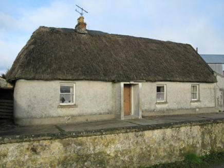 farm house1676 yd
,_Newcastle_West,_Limerick_-_geograph.org.uk_-_1392672.jpg/250px-Castles_of_Munster,_Desmond_Hall_(Castle_Banqueting_Hall),_Newcastle_West,_Limerick_-_geograph.org.uk_-_1392672.jpg "Photo: Mike Searle, Wikimedia Commons · CC BY-SA 2.0") Templars Castle (in ruins)Castle, Anglo-Norman masonry castle · 2.5 mi
Templars Castle (in ruins)Castle, Anglo-Norman masonry castle · 2.5 mi European ash2.6 mi
 Castle MahonCastle · 2.8 mi
 Ardagh FortArchaeological place · 3.0 miSt. Kieran's WellSpring · 3.2 mi
 Saint Ite's WellSpring · 6.4 mi
 Monterey Cypress11 mi
More archaeology and monuments in County Limerick · All of County Limerick
What do you know about this place?