What is recorded here
Top of a drumlin in Correen, a 35-metre earthen ring still presses against the field banks that hem it in. Called a fairy fort in local speech, it is the kind of place people once pointed to when asking why the land keeps its own shapes. Grass and rush may smother the bank now, but the circle remains clear enough to walk around and imagine inside.
Situated on top of a drumlin. This is depicted as a circular embanked enclosure (ext. diam. c. 35m) constrained by a N-S field bank at W and a NW-SE field bank at S on the 1835 edition of the OS 6-inch map where it is described as a ‘Fort’. It is represented as an equally constrained hachured feature on the 1945 revision. This was barely visible in 1991 (SMR file) as a grass and rush-covered circular area (diam. c. 40m) defined by a band of thin vegetation on the site of the bank at N and E and by levelled hedgerows at S and W.
The above description is derived from 'The Archaeological Inventory of County Leitrim' compiled by Michael J. Moore (Dublin: Stationery Office, 2003). In certain instances the entries have been revised and updated in the light of recent research.
Compiled by: Michael Moore
Date of revised upload: 15 October 2019
The monument record does not grant public access. Check the route and ask the landowner before entering private land.
- What survives
- Recorded monument
Places near here
 IndicatedFairy fort / earthen ringfort · 417 yd
 LisduffFairy fort / earthen ringfort · 572 yd
 R. C. ChapelChurch · 719 yd
 CastlecarraCastle, unclassified · 749 yd
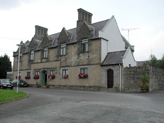 Summerhill Lodgeworkhouse administration block · 1.1 mi
 Moon RiverHeritage attraction · 1.5 mi
 PortCastle, unclassified · 2.2 mi
 Patrick Gill Memorial Plaque (IRA)Monument · 2.6 mi
 Robert Strawbridge MemorialMemorial · 2.6 mi
 Wildlife AreaNature reserve · 2.9 mi
 Leabaidh DermotCave · 3.6 mi
 Hughestown WoodForest · 3.9 mi