What is recorded here
Killagriff holds a fourty-foot clay dish on a south-facing ridge, its hidden entrance swallowed by centuries of grass and forgotten feet. The fairies never showed themselves, but the shape remained, waiting for someone stubborn enough to stop asking permission and start watching. What is absent is not nothing. It is the part you have not learned to see.
Situated on the S-facing slope of a slight NNW-SSE ridge. This is a circular grass-covered area (diam. 43.5m N-S; 42m E-W) defined by a grass-covered scarp (at S: Wth 2.4m; H 1.6m) with some bushes that is incorporated into a field bank and hedge WNW-N but it is slightly truncated by a NW-SE field bank at NE. There is no visible fosse or identifiable original entrance.
The above description is derived from the published 'Archaeological Inventory of County Meath' (Dublin: Stationery Office, 1987). In certain instances the entries have been revised and updated in the light of recent research.
Compiled by: Michael Moore
Date of revision: 31 August 2018
The monument record does not grant public access. Check the route and ask the landowner before entering private land.
- What survives
- Recorded monument
Places near here
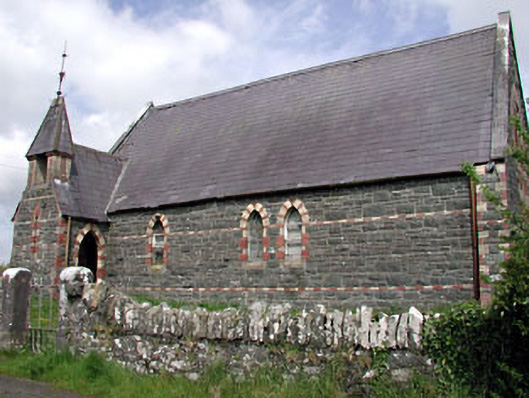 Saint Columba's Church (Moybolgue)church/chapel · 1.0 mi
 EnclosureEnclosure, large enclosure · 1.0 mi
 TeevurcherMountain / peak · 1.2 mi
 Fulacht fia in AgheraghFulacht fia · 1.2 mi
 Church (in ruins)Church · 1.5 mi
 MoatCastle, motte and bailey · 1.6 mi
 Blackhills LowerMountain / peak · 1.7 mi
 Tullynaskeagh EastForest · 2.0 mi
 CastleCastle, tower house · 2.2 mi
 Tullynaskeagh WestForest · 2.5 mi
 Fair of MuffMemorial · 3.5 mi
 Sally IslandIslet · 4.2 mi