What is recorded here
According to the Civil Survey (1654-6) Henry Betagh owned 429 acres at Newcastle in 1640 and on the premises was ‘a ruinous castle’ (Simington 1940, 301). Henry also owned 132 acres in Corbogg, but other members of the family owned most of the rest of the parish (ibid. 299-302). The castle is not indicated on any OS map, but it is marked on a manuscript map (ms: 21 F 14 (43) in NLI. It is situated on a local rise. One wall (L c. 7m N-S; T 1.5m; H c. 2m) with a fragment of a curving tower at its N end but no architectural features survives incorporated into the W wall of a farm building. This is probably the W wall of a bawn.
According to the Civil Survey (1654-6) Henry Betagh owned 429 acres at Newcastle in 1640 and on the premises was ‘a ruinous castle’ (Simington 1940, 301). Henry also owned 132 acres in Corbogg, but other members of the family owned most of the rest of the parish (ibid. 299-302). The castle is not indicated on any OS map, but it is marked on a manuscript map (ms: 21 F 14 (43) in NLI. It is situated on a local…
From the National Monuments Service (Archaeological Survey of Ireland) record ME004-007
The monument record does not grant public access. Check the route and ask the landowner before entering private land.
- What survives
- Recorded monument
Places near here
Photo credits
- National Inventory of Architectural Heritage
- Wanfried-Dublin, Wikimedia Commons · CC BY 4.0
- Kieran Campbell, Geograph · Creative Commons Attribution-ShareAlike 2.0
- Kieran Campbell, Geograph · CC BY-SA 2.0
- Oliver Dixon, Geograph · CC BY-SA 2.0
- Mike Searle, Geograph · CC BY-SA 2.0
- Garry Dickinson, Geograph · CC BY-SA 2.0
 Annesbrook BridgeBridge · 1268 yd
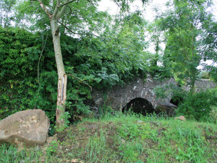 Skearke BridgeBridge · 1477 yd
.jpg/250px-Rantavan-Mullagh_(2).jpg "Photo: Wanfried-Dublin, Wikimedia Commons · CC BY 4.0") Ogham stone (present location) in MullaghOgham stone (present location) · 2.0 mi
Ogham stone (present location) in MullaghOgham stone (present location) · 2.0 mi Grave YardGraveyard · 2.2 miSally IslandIslet · 2.2 miGreen IslandWood · 2.2 mi
 EnaghMountain / peak · 4.9 mi
 LoughanleaghForest · 5.1 mi
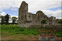 IndicatedHouse, fortified house · 5.6 mi
 Bawn in Robertstown (kells Lower By.)Bawn · 5.6 mi
 Fair of MuffVisitor information · 5.6 mi
 Fair of MuffMemorial · 5.6 mi
More castles and forts in County Meath · All of County Meath
What do you know about this place?