
What is recorded here
From the National Monuments Service (Archaeological Survey of Ireland) record LH021-079
Places near here
Photo credits
- National Inventory of Architectural Heritage
- Photographer not named in LMFM caption, www.lmfm.ie
- Lior Kogan, Wikimedia Commons · CC BY-SA 4.0
- Andreas F. Borchert, Wikimedia Commons · CC BY-SA 4.0
- Adriao, Wikimedia Commons · CC BY-SA 4.0
- Kevin King, Wikimedia Commons · CC BY 2.0
- Colin Park, Geograph · CC BY-SA 2.0
- Willard Rome, Geograph · CC BY-SA 2.0
- Maker not stated on source page, commons.wikimedia.org
- Maker not stated on source page, en.wikipedia.org
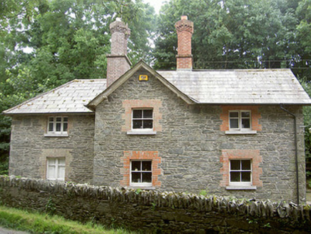 Monasterboice HouseGate lodge · 1184 yd
Explorer Tom Monasterboice House is having a feud with the next village over something daft, probably about whose gate lodge has…
 outbuilding1359 yd
Explorer Tom Outbuilding in Newtown Monasterboice refuses to fall down because it’s stubborn as hell. It’s an extensive linear…
 Naomh Mairtin GAA, MonasterboiceGAA ground · 1543 yd
 Stone CrossesCross, High cross · 1.1 mi
Explorer Tom Monasterboice stone crosses would file a complaint with the council about the amount of tourists taking selfies on…
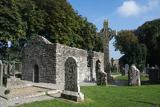 MonasterboiceEarly monastic site · 1.1 mi
Explorer Tom Monasterboice in County Louth is run by a dog that barks at monks, deciding who gets to sit where. Pretend you're a…
 Muiredach's High CrossHeritage attraction · 1.1 mi
Explorer Tom You think I can read every carving on Muiredach's Cross? Pull up a chair. Muiredach's High Cross at Monasterboice is a…
 Monasterboice AbbeyRuins · 1.1 mi
Explorer Tom You came to Monasterboice for one high cross? Louth has laid out three and a round tower to keep you busy. Saint Buithe…
 Monasterboice Round TowerHeritage attraction · 1.1 mi
Explorer Tom Monasterboice Round Tower has decided its New Year's resolution is to stop being so tall and start being more…
 Round Tower1.1 mi
Explorer Tom Monasterboice round tower lost a bet with a priest who claimed he could climb it in his slippers. It’s still standing…
 Holy well in BawntaaffeHoly well · 1.2 mi
Explorer Tom Holy well in Bawntaaffe once had a dragon fly over it, allegedly. No proof, but the locals swear on their grandmothers’…
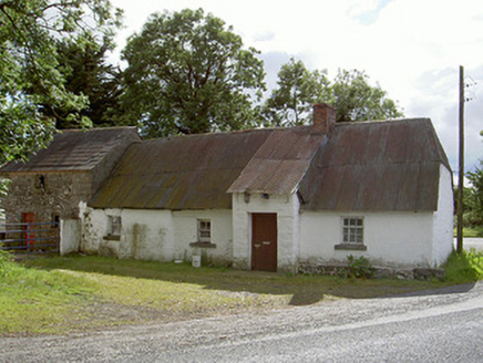 Halfway HouseHouse · 1.3 mi
Explorer Tom Halfway House would rate its visitors two stars out of five for effort. It’s a low, long vernacular complex with…
 Enclosure in HurcleEnclosure · 1.7 mi
Explorer Tom Enclosure in Hurcle is an oval near a river that is sick of being asked if it’s haunted, because no, it’s just damp and…
More archaeology and monuments in County Louth · All of County Louth

What do you know about this place?Tap to add a comment or ask a question