What is recorded here
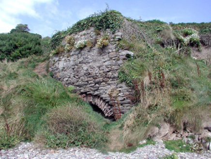
Located on a grass-covered coastal promontory (int. dims. c. 43m N-S; c. 12-18m E-W) that is defended on the landward side to the N by a fosse (Wth of top 13.4m; Wth of base 4.4m; int. D 3.8m), a central bank (Wth 7m; H over the inner fosse 5.9m; H over outer fosse 3.1m) and an outer fosse (Wth of top 9.2m; Wth of base 2.9m; ext. D 4.1m). Outer earthworks marked on the 1840 ed. of the OS 6-inch map had been levelled by 1906 (Westropp 1906, 252). The entrance through the bank was created in the late 19th century, when an inner stone bank may have been removed (Westropp 1914-16, 218-19). A field bank (max. int. H 1.6m at W) surrounds all sides of the promontory. Within the defences are two possible hut sites (int. dims. 5.2m x 4.1m; 7.8m x 6.9m) visbile as sunken areas, but a stone with a possible ogham inscription, described by Westropp (1906, 250) and now missing, is probably a plough-marked stone. A possible Man-made underground passage was described by Westropp as blocked with stones (ibid. 250), but its hollow is still visible.
Located on a grass-covered coastal promontory (int. dims. c. 43m N-S; c. 12-18m E-W) that is defended on the landward side to the N by a fosse (Wth of top 13.4m; Wth of base 4.4m; int. D 3.8m), a central bank (Wth 7m; H over the inner fosse 5.9m; H over outer fosse 3.1m) and an outer fosse (Wth of top 9.2m; Wth of base 2.9m; ext. D 4.1m). Outer earthworks marked on the 1840 ed. of the OS 6-inch map had been…
From the National Monuments Service (Archaeological Survey of Ireland) record WA032-028001
The monument record does not grant public access. Check the route and ask the landowner before entering private land.
- What survives
- Recorded monument
Places near here
Grange WellSpring · 718 ydCairnCairn, unclassified · 1282 yd Historic buildingOfficially recorded historic building · 1509 ydBallyvoyle BridgeOfficially recorded historic building · 1555 ydStradbally CoveBeach / strand · 1.7 miCastleStructure · 1.8 miStradbally Geological SundialHeritage attraction · 2.0 miBawn in Castlequarter (decies Without Drum By., Kilrossanty Par.)Bawn · 2.3 miClonea StrandBeach / strand · 2.3 miSite of CastleCastle, unclassified · 2.5 miHorse-chestnut4.3 miErin's Hope 1867Memorial · 4.4 mi
 Historic buildingOfficially recorded historic building · 1509 yd
 Ballyvoyle BridgeOfficially recorded historic building · 1555 yd
 Stradbally CoveBeach / strand · 1.7 mi
 CastleStructure · 1.8 miStradbally Geological SundialHeritage attraction · 2.0 miBawn in Castlequarter (decies Without Drum By., Kilrossanty Par.)Bawn · 2.3 mi
 Clonea StrandBeach / strand · 2.3 miSite of CastleCastle, unclassified · 2.5 mi
 Horse-chestnut4.3 mi
 Erin's Hope 1867Memorial · 4.4 mi
Pictures: National Inventory of Architectural Heritage; Katie Crampton (WMUK), Wikimedia Commons · CC BY 4.0; John M, Geograph · CC BY-SA 2.0; Robert French, Wikimedia Commons · Public domain; Susan Pike, Geograph · CC BY-SA 2.0; Stephan van Helden, Wikimedia Commons · CC BY-SA 4.0; Alexander Redfern, Wikimedia Commons · CC BY-SA 4.0
More archaeology and monuments in County Waterford · All of County Waterford
What do you know about this place?