
More pictures of this place

What is recorded here
Three-arch rubble stone road bridge over river, dated 1824. Broken coursed squared rubble stone walls with cut-stone triangular cut-waters to piers, and random rubble stone parapets having cut-stone coping. Series of three round arches with cut-stone voussoirs (one inscribed as date stone), and squared rubble stone soffits having remains of render over. Sited spanning Dalligan River at estuary with gravel banks to river.
An elegantly-composed bridge forming an appealing landmark on the Dalligan River. The construction of the arches, which have retained their original form and profile, identifies the civil engineering heritage importance of the composition.
The story behind this place
Sited spanning Dalligan River at estuary with gravel banks to river.
From the Buildings of Ireland (National Inventory of Architectural Heritage) record 22903201
This does not grant access. Most recorded buildings are privately owned; view them only from public ground unless the owner allows entry.
Places near here
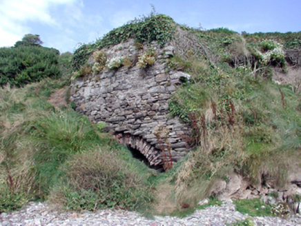 Historic buildingOfficially recorded historic building · 46 ydCairnCairn, unclassified · 190 yd
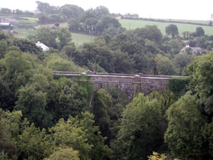 Ballyvoyle New BridgeOfficially recorded historic building · 1065 yd
 CastleStructure · 1720 yd
 Clonea StrandBeach / strand · 1.5 mi
 Horse-chestnut3.5 mi
 Erin's Hope 1867Memorial · 3.9 mi
 Cunnigar PointHeadland · 4.5 mi
 Dungarvan CastleCastle · 4.6 mi
 Dungarvan Castle (in Ruins)Castle, Anglo-Norman masonry castle · 4.6 mi
 Waterford County MuseumMuseum · 4.8 mi
 Grattan SquareVisitor information · 4.8 mi
Pictures: National Inventory of Architectural Heritage; Robert French, Wikimedia Commons · Public domain; Susan Pike, Geograph · CC BY-SA 2.0; Stephan van Helden, Wikimedia Commons · CC BY-SA 4.0; Alexander Redfern, Wikimedia Commons · CC BY-SA 4.0; Colin Park, Geograph · CC BY-SA 2.0; Audrius Janecka, Wikimedia Commons · CC BY-SA 4.0; Oliver Dixon, Geograph · CC BY-SA 2.0; Slamforeman, Wikimedia Commons · CC BY 4.0
More historic places in County Waterford · All of County Waterford
What do you know about this place?