What is recorded here
Located on a fairly level low-lying landscape. The cropmark of a large subcircular area (dims c. 100m N-S; c. 85m E-W) defined by a single ditch or drain (Wth c. 2-5m) is visible only on Google Earth (18/07/2021). The cropmark of a rectangular quarry (dims c. 30m E-W; c. 20m N-S) is in the NE part of the interior, and the enclosing element might just be drainage around a slightly raised area. It was first reported by Jean Charles Cailére. See the attached enhanced view from Google Earth (18/07/2021)
Compiled by: Michael Moore
Date of upload: 4 January 2022
Located on a fairly level low-lying landscape. The cropmark of a large subcircular area (dims c. 100m N-S; c. 85m E-W) defined by a single ditch or drain (Wth c. 2-5m) is visible only on Google Earth (18/07/2021). The cropmark of a rectangular quarry (dims c. 30m E-W; c. 20m N-S) is in the NE part of the interior, and the enclosing element might just be drainage around a slightly raised area. It was first…
From the National Monuments Service (Archaeological Survey of Ireland) record WX038-012
The monument record does not grant public access. Check the route and ask the landowner before entering private land.
- What survives
- Recorded monument
Places near here
Photo credits
- National Inventory of Architectural Heritage
- Thommcg1980, Wikimedia Commons · CC BY-SA 4.0
- Chris, Wikimedia Commons · CC BY-SA 2.0
- AFBorchert, Wikimedia Commons · CC BY-SA 4.0
- Danielclauzier, Wikimedia Commons · CC BY-SA 3.0
- Sarah777 at English Wikipedia, Wikimedia Commons · Public domain
- Michal Osmenda, Wikimedia Commons · CC BY-SA 2.0
- Maker named on the Wikimedia Commons picture page · CC BY-SA 3.0
St. Colums WellHoly well · 130 yd farm house213 ydfarm house1440 ydSt. Cavans WellHoly well · 1587 ydCastle (in ruins)Castle, unclassified · 1.0 miCommodore John Barry MemorialMemorial · 2.7 miRaven Point Nature ReserveForest · 2.8 miSiege of WexfordSiege · 2.9 miSack of WexfordSiege · 2.9 miCurracloe BeachBeach / strand · 3.0 miBallinesker BeachBeach / strand · 3.5 miDawn Redwood4.7 mi
 farm house213 yd
 farm house1440 ydSt. Cavans WellHoly well · 1587 ydCastle (in ruins)Castle, unclassified · 1.0 mi
 Commodore John Barry MemorialMemorial · 2.7 mi
 Raven Point Nature ReserveForest · 2.8 mi
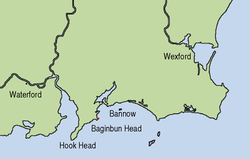 Siege of WexfordSiege · 2.9 mi
 Sack of WexfordSiege · 2.9 mi
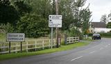 Curracloe BeachBeach / strand · 3.0 mi
 Ballinesker BeachBeach / strand · 3.5 mi
 Dawn Redwood4.7 mi
More archaeology and monuments in County Wexford · All of County Wexford
What do you know about this place?