What is recorded here
Ballytramon was also known as Farrelstown, and it was held in the later 16th century by a branch of the Synotts of Ballybrennan (WX048-001----) in Forth barony (Hore 1900-11, vol. 5, 401). The Synotts appear to have sold it to Lord Esmonde of Limerick (WX003-024----) in 1626, and his son, Sir Thomas Esmonde, is said to have re-built the castle (Jeffrey 1979, 97 8). According to the Civil Survey (1654-6) Sir Thomas Esmonde owned ‘a faire house’ at Ballytramon together with 800 acres in Ardcavan parish at Ballytramon, Ballywish, Ballymartin, Crosstown, Ardcavan, Great Island (Big Island), Ferrybank and the unknown Rath & knattan (Knottown?) (Simington 1953, 113). The castle was situated on a local rise in a low-lying landscape on the E side of the inner harbour of Wexford. It is described (Wexford People 14-6-1913) as an oblong with one and possibly two diagonally opposed circular towers. It was occupied into the late 19th century and may have been a fortified house. It collapsed in 1940, and there are no visible remains of a structure at ground level in a farmyard. See the attached section from the Down Survey (1656-8) parish map (N at left) reproduced courtesy of the National Library of Ireland (Ms 725)
The above description is derived from the published 'Archaeological Inventory of County Wexford' (Dublin: Stationery Office, 1996).
Ballytramon was also known as Farrelstown, and it was held in the later 16th century by a branch of the Synotts of Ballybrennan (WX048-001----) in Forth barony (Hore 1900-11, vol. 5, 401). The Synotts appear to have sold it to Lord Esmonde of Limerick (WX003-024----) in 1626, and his son, Sir Thomas Esmonde, is said to have re-built the castle (Jeffrey 1979, 97 8). According to the Civil Survey (1654-6) Sir…
From the National Monuments Service (Archaeological Survey of Ireland) record WX037-009001
This remains an important historical record, but the official description says the monument is no longer visible or has been destroyed. The monument record does not grant public access. Check the route and ask the landowner before entering private land.
- What survives
- No visible remains or recorded as destroyed
Places near here
Photo credits
- National Inventory of Architectural Heritage
- David Hawgood, Wikimedia Commons · CC BY-SA 2.0
- Mike Searle, Wikimedia Commons · CC BY-SA 2.0
- Thommcg1980, Wikimedia Commons · CC BY-SA 4.0
- AFBorchert, Wikimedia Commons · CC BY-SA 4.0
- Danielclauzier, Wikimedia Commons · CC BY-SA 3.0
- Chris, Wikimedia Commons · CC BY-SA 2.0
- Maker named on the Wikimedia Commons picture page · CC BY-SA 3.0
- Sarah777 at English Wikipedia, Wikimedia Commons · Public domain
- Michal Osmenda, Wikimedia Commons · CC BY-SA 2.0
- Richard Webb, Geograph · CC BY-SA 2.0
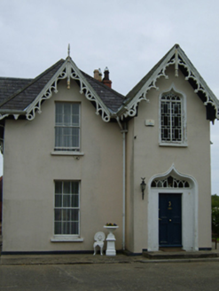 Como LodgeHouse · 1031 yd
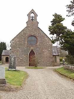 Ardcolm ChurchChurch/chapel · 1239 yd
 malt house1270 yd
_-_geograph.org.uk_-_4570708.jpg/250px-Castles_of_Leinster,_Artramon,_Wexford_(2)_-_geograph.org.uk_-_4570708.jpg "Photo: Mike Searle, Wikimedia Commons · CC BY-SA 2.0") Artramon CastleCastle, tower house · 1.1 mi
Artramon CastleCastle, tower house · 1.1 mi Commodore John Barry MemorialMemorial · 2.4 mi
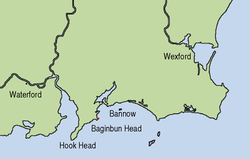 Siege of WexfordSiege · 2.7 mi
 Sack of WexfordSiege · 2.7 mi
 Raven Point Nature ReserveForest · 3.8 mi
 Dawn Redwood4.0 mi
 Curracloe BeachBeach / strand · 4.0 mi
 Ballinesker BeachBeach / strand · 4.5 mi
 Forth MountainMountain / peak · 6.0 mi
More castles and forts in County Wexford · All of County Wexford
What do you know about this place?